
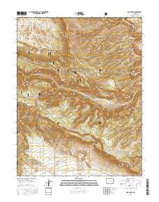
~ Roc Creek CO topo map, 1:24000 scale, 7.5 X 7.5 Minute, 2016
Roc Creek, Colorado, USGS topographic map dated 2016.
Includes geographic coordinates (latitude and longitude). This topographic map is suitable for hiking, camping, and exploring, or framing it as a wall map.
Printed on-demand using high resolution imagery, on heavy weight and acid free paper, or alternatively on a variety of synthetic materials.
Topos available on paper, Waterproof, Poly, or Tyvek. Usually shipping rolled, unless combined with other folded maps in one order.
- Product Number: USGS-8371514
- Free digital map download (high-resolution, GeoPDF): Roc Creek, Colorado (file size: 33 MB)
- Map Size: please refer to the dimensions of the GeoPDF map above
- Weight (paper map): ca. 55 grams
- Map Type: POD USGS Topographic Map
- Map Series: US Topo
- Map Verison: Current
- Cell ID: 38174
- Datum: North American Datum of 1983
- Map Projection: Transverse Mercator
- Map Cell Name: Roc Creek
- Grid size: 7.5 X 7.5 Minute
- Date on map: 2016
- Map Scale: 1:24000
- Geographical region: Colorado, United States
Neighboring Maps:
All neighboring USGS topo maps are available for sale online at a variety of scales.
Spatial coverage:
Topo map Roc Creek, Colorado, covers the geographical area associated the following places:
- Shuffle Mine - Roc Creek Mine - Pace Ranch - Sunrise Mine - Radium Cycle Mine - Little Fawn Mine - Hog Trough - Three Musketeers Mine - Cedar Group Mine - Twin Sisters Mine - Eclipse Mine - Rajah Mine - Sinbad Group Mine - Red Beds Mine - Copper Jack Mine - Shadow Mine - A and H Mine - Shamrock Mine - Woodchuck Mine - Fairview Mine - Uranium (historical) - Belle of Montrose Mine - Redbird Mine - Carpenter Flats - Garvey Gulch - Rogers Mine - Judy Ann Mine - Mesa Two Mine - Carpenter Ridge - Sunrise Canyon - Red Hill Group Mine - Little Buckhorn Mine - Redbird Mine - Sewemup Mesa - Shadow Rock Mine - Big Chief Mine - Buckhorn Mine - Zella Mine - Linscott Canyon - Waterloo Mine - Hot Dog Mine - Lone Pine Mine
- Map Area ID: AREA38.538.375-109-108.875
- Northwest corner Lat/Long code: USGSNW38.5-109
- Northeast corner Lat/Long code: USGSNE38.5-108.875
- Southwest corner Lat/Long code: USGSSW38.375-109
- Southeast corner Lat/Long code: USGSSE38.375-108.875
- Northern map edge Latitude: 38.5
- Southern map edge Latitude: 38.375
- Western map edge Longitude: -109
- Eastern map edge Longitude: -108.875


