
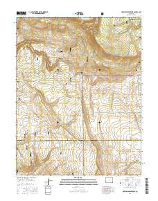
~ Hotchkiss Reservoir CO topo map, 1:24000 scale, 7.5 X 7.5 Minute, 2016
Hotchkiss Reservoir, Colorado, USGS topographic map dated 2016.
Includes geographic coordinates (latitude and longitude). This topographic map is suitable for hiking, camping, and exploring, or framing it as a wall map.
Printed on-demand using high resolution imagery, on heavy weight and acid free paper, or alternatively on a variety of synthetic materials.
Topos available on paper, Waterproof, Poly, or Tyvek. Usually shipping rolled, unless combined with other folded maps in one order.
- Product Number: USGS-8371484
- Free digital map download (high-resolution, GeoPDF): Hotchkiss Reservoir, Colorado (file size: 27 MB)
- Map Size: please refer to the dimensions of the GeoPDF map above
- Weight (paper map): ca. 55 grams
- Map Type: POD USGS Topographic Map
- Map Series: US Topo
- Map Verison: Current
- Cell ID: 21200
- Datum: North American Datum of 1983
- Map Projection: Transverse Mercator
- Map Cell Name: Hotchkiss Reservoir
- Grid size: 7.5 X 7.5 Minute
- Date on map: 2016
- Map Scale: 1:24000
- Geographical region: Colorado, United States
Neighboring Maps:
All neighboring USGS topo maps are available for sale online at a variety of scales.
Spatial coverage:
Topo map Hotchkiss Reservoir, Colorado, covers the geographical area associated the following places:
- Section 7 Reservoir - North Fork Horsefly Creek - Loss Spring - Stuarts Springs - Smith Reservoir - Sidehill Reservoir - Loss Reservoir - Rattlesnake Claims - Edmondson Spring - V H Camp - Galloway Spring - Z K Reservoir - Go Back Reservoir - Galloway Camp - V H Pasture Reservoir - Tikka Reservoir - Barnes Mill Reservoir - Z K Spring - Clear Creek - Spear Ranch - Trail Reservoir - South Fork Horsefly Creek - Turkey Plot Reservoir - Tommy Pond Spring - Vurl Reservoir - Cedar Spring - Lewis Reservoir - Fire Box Reservoir - North Creek Reservoir - Turkey Plot Spring - Geyser Reservoir - Hotchkiss Reservoir - P D C Camp - Coyote Knob - Jutten Camp
- Map Area ID: AREA38.2538.125-108.125-108
- Northwest corner Lat/Long code: USGSNW38.25-108.125
- Northeast corner Lat/Long code: USGSNE38.25-108
- Southwest corner Lat/Long code: USGSSW38.125-108.125
- Southeast corner Lat/Long code: USGSSE38.125-108
- Northern map edge Latitude: 38.25
- Southern map edge Latitude: 38.125
- Western map edge Longitude: -108.125
- Eastern map edge Longitude: -108


