
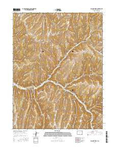
~ No Name Ridge CO topo map, 1:24000 scale, 7.5 X 7.5 Minute, 2016
No Name Ridge, Colorado, USGS topographic map dated 2016.
Includes geographic coordinates (latitude and longitude). This topographic map is suitable for hiking, camping, and exploring, or framing it as a wall map.
Printed on-demand using high resolution imagery, on heavy weight and acid free paper, or alternatively on a variety of synthetic materials.
Topos available on paper, Waterproof, Poly, or Tyvek. Usually shipping rolled, unless combined with other folded maps in one order.
- Product Number: USGS-8363896
- Free digital map download (high-resolution, GeoPDF): No Name Ridge, Colorado (file size: 32 MB)
- Map Size: please refer to the dimensions of the GeoPDF map above
- Weight (paper map): ca. 55 grams
- Map Type: POD USGS Topographic Map
- Map Series: US Topo
- Map Verison: Current
- Cell ID: 32187
- Datum: North American Datum of 1983
- Map Projection: Transverse Mercator
- Map Cell Name: No Name Ridge
- Grid size: 7.5 X 7.5 Minute
- Date on map: 2016
- Map Scale: 1:24000
- Geographical region: Colorado, United States
Neighboring Maps:
All neighboring USGS topo maps are available for sale online at a variety of scales.
Spatial coverage:
Topo map No Name Ridge, Colorado, covers the geographical area associated the following places:
- Chimney Rock Gulch - Turkey Canyon - Goat Trail Ridge - King Gulch - North Hollow - Devils Canyon - Dark Canyon - Harrison Gulch - Rough Gulch - Jacks Gulch - Hyberger Gulch - Jones Ranch - Charley Earl Gulch - Road Draw - Schutte Gulch - Buck Ridge - Gigandet Gulch - No Name Ridge - Quaker Gulch - Deer Gulch - Summer Camp Gulch - Coyote Gulch - Halfmoon Gulch - Open Gulch - Cox Ranch - Clubine Ranch - Story Gulch - Fourteenmile Creek - Pre-emption Gulch - Two Buck Gulch - Hannahan Gulch - Sprague Gulch - East Gordon Gulch - Moonlight Gulch - Robinson Ranch - West Gordon Gulch - Dry Thirteenmile Creek - Davis Gulch - Bald Knob - Trail Ridge - Fourteenmile Ridge - Cabin Gulch
- Map Area ID: AREA39.87539.75-108.125-108
- Northwest corner Lat/Long code: USGSNW39.875-108.125
- Northeast corner Lat/Long code: USGSNE39.875-108
- Southwest corner Lat/Long code: USGSSW39.75-108.125
- Southeast corner Lat/Long code: USGSSE39.75-108
- Northern map edge Latitude: 39.875
- Southern map edge Latitude: 39.75
- Western map edge Longitude: -108.125
- Eastern map edge Longitude: -108


