
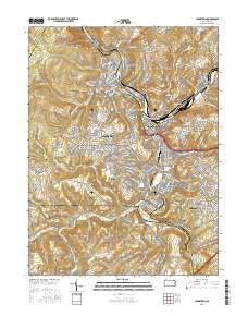
~ Johnstown PA topo map, 1:24000 scale, 7.5 X 7.5 Minute, 2016
Johnstown, Pennsylvania, USGS topographic map dated 2016.
Includes geographic coordinates (latitude and longitude). This topographic map is suitable for hiking, camping, and exploring, or framing it as a wall map.
Printed on-demand using high resolution imagery, on heavy weight and acid free paper, or alternatively on a variety of synthetic materials.
Topos available on paper, Waterproof, Poly, or Tyvek. Usually shipping rolled, unless combined with other folded maps in one order.
- Product Number: USGS-8288076
- Free digital map download (high-resolution, GeoPDF): Johnstown, Pennsylvania (file size: 32 MB)
- Map Size: please refer to the dimensions of the GeoPDF map above
- Weight (paper map): ca. 55 grams
- Map Type: POD USGS Topographic Map
- Map Series: US Topo
- Map Verison: Current
- Cell ID: 22735
- Datum: North American Datum of 1983
- Map Projection: Transverse Mercator
- Map Cell Name: Johnstown
- Grid size: 7.5 X 7.5 Minute
- Date on map: 2016
- Map Scale: 1:24000
- Geographical region: Pennsylvania, United States
Neighboring Maps:
All neighboring USGS topo maps are available for sale online at a variety of scales.
Spatial coverage:
Topo map Johnstown, Pennsylvania, covers the geographical area associated the following places:
- Prospect - Belmont - Tire Hill - Stonycreek - Southmont - Walsall - Hornerstown - Roxbury - Cover Hill - Johnstown - Conemaugh - Parkstown - Oakhurst - Riverside - Bens Creek - East Conemaugh - Brownstown - Kernville - Ingleside - Elim - Oakland - Westmont - Lorain - Coopersdale - Krings - Goods Corner - Walnut Grove - Woodvale - Minersville - Daisytown - Moxham - Cambria City - Ferndale - Franklin - Pleasant Hill - Dale
- Map Area ID: AREA40.37540.25-79-78.875
- Northwest corner Lat/Long code: USGSNW40.375-79
- Northeast corner Lat/Long code: USGSNE40.375-78.875
- Southwest corner Lat/Long code: USGSSW40.25-79
- Southeast corner Lat/Long code: USGSSE40.25-78.875
- Northern map edge Latitude: 40.375
- Southern map edge Latitude: 40.25
- Western map edge Longitude: -79
- Eastern map edge Longitude: -78.875


