
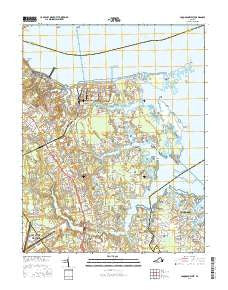
~ Poquoson West VA topo map, 1:24000 scale, 7.5 X 7.5 Minute, 2016
Poquoson West, Virginia, USGS topographic map dated 2016.
Includes geographic coordinates (latitude and longitude). This topographic map is suitable for hiking, camping, and exploring, or framing it as a wall map.
Printed on-demand using high resolution imagery, on heavy weight and acid free paper, or alternatively on a variety of synthetic materials.
Topos available on paper, Waterproof, Poly, or Tyvek. Usually shipping rolled, unless combined with other folded maps in one order.
- Product Number: USGS-8248578
- Free digital map download (high-resolution, GeoPDF): Poquoson West, Virginia (file size: 23 MB)
- Map Size: please refer to the dimensions of the GeoPDF map above
- Weight (paper map): ca. 55 grams
- Map Type: POD USGS Topographic Map
- Map Series: US Topo
- Map Verison: Current
- Cell ID: 35999
- Datum: North American Datum of 1983
- Map Projection: Transverse Mercator
- Map Cell Name: Poquoson West
- Grid size: 7.5 X 7.5 Minute
- Date on map: 2016
- Map Scale: 1:24000
- Geographical region: Virginia, United States
Neighboring Maps:
All neighboring USGS topo maps are available for sale online at a variety of scales.
Spatial coverage:
Topo map Poquoson West, Virginia, covers the geographical area associated the following places:
- Dalbytown - Loweman Court Trailer Park - Freemoor Estates - Poor Farm - Robanna Shores - Harwoods Mill - Nelson Heights - Barcroft - Sulik Mobile Home Court - Dandy - Dare - Colonial Trailer Court - York Haven Anchorage - Edgehill - Grafton Mobile Home Park - Goodwin Neck Estates - Mill Farms - Holly Hills - Lakeside Homes - Harris Grove - Seaford Shores - Poquoson River Estates - La Tierra - Seaford - Acree Acres - Battle Park - Piney Point Estates - Hornsbyville - Grafton - Poquoson Shores - Powhatan Place - Moores - Marlbank - Evergreen Shores - Kentucky Farms - Heritage Hamlet - Yorkville - Rivergate - Burts
- Map Area ID: AREA37.2537.125-76.5-76.375
- Northwest corner Lat/Long code: USGSNW37.25-76.5
- Northeast corner Lat/Long code: USGSNE37.25-76.375
- Southwest corner Lat/Long code: USGSSW37.125-76.5
- Southeast corner Lat/Long code: USGSSE37.125-76.375
- Northern map edge Latitude: 37.25
- Southern map edge Latitude: 37.125
- Western map edge Longitude: -76.5
- Eastern map edge Longitude: -76.375


