
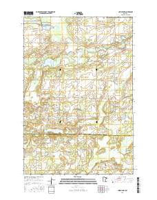
~ Lastrup NW MN topo map, 1:24000 scale, 7.5 X 7.5 Minute, 2016
Lastrup NW, Minnesota, USGS topographic map dated 2016.
Includes geographic coordinates (latitude and longitude). This topographic map is suitable for hiking, camping, and exploring, or framing it as a wall map.
Printed on-demand using high resolution imagery, on heavy weight and acid free paper, or alternatively on a variety of synthetic materials.
Topos available on paper, Waterproof, Poly, or Tyvek. Usually shipping rolled, unless combined with other folded maps in one order.
- Product Number: USGS-8227762
- Free digital map download (high-resolution, GeoPDF): Lastrup NW, Minnesota (file size: 23 MB)
- Map Size: please refer to the dimensions of the GeoPDF map above
- Weight (paper map): ca. 55 grams
- Map Type: POD USGS Topographic Map
- Map Series: US Topo
- Map Verison: Current
- Cell ID: 25048
- Datum: North American Datum of 1983
- Map Projection: Transverse Mercator
- Map Cell Name: Lastrup NW
- Grid size: 7.5 X 7.5 Minute
- Date on map: 2016
- Map Scale: 1:24000
- Geographical region: Minnesota, United States
Neighboring Maps:
All neighboring USGS topo maps are available for sale online at a variety of scales.
Spatial coverage:
Topo map Lastrup NW, Minnesota, covers the geographical area associated the following places:
- Township of Daggett Brook - Hagen-Arnestad Cemetery - District Number 19 School - Round Lake Dam - Lodemier Lake - Hampton Lake - District Number 49 School - Mud Lake - Ashenbrenner Lake - District Number 84 School - Pond Lily Lake - Sewells Pond - Black Brook Swamp - Little Crody Lake - District Number 112 and 148 School - Pond Lake - Crody Lake - Lake Shay - Round Lake - Kohl Landing Strip (historical) - Fuchs Lake - Riverside Cemetery - District Number 39 School - Crow Wing Church - Brainerd Lookout Tower
- Map Area ID: AREA46.2546.125-94.25-94.125
- Northwest corner Lat/Long code: USGSNW46.25-94.25
- Northeast corner Lat/Long code: USGSNE46.25-94.125
- Southwest corner Lat/Long code: USGSSW46.125-94.25
- Southeast corner Lat/Long code: USGSSE46.125-94.125
- Northern map edge Latitude: 46.25
- Southern map edge Latitude: 46.125
- Western map edge Longitude: -94.25
- Eastern map edge Longitude: -94.125


