
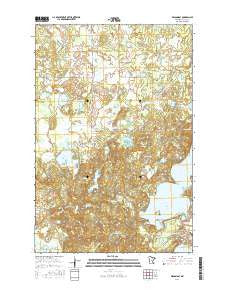
~ Wilson Bay MN topo map, 1:24000 scale, 7.5 X 7.5 Minute, 2016
Wilson Bay, Minnesota, USGS topographic map dated 2016.
Includes geographic coordinates (latitude and longitude). This topographic map is suitable for hiking, camping, and exploring, or framing it as a wall map.
Printed on-demand using high resolution imagery, on heavy weight and acid free paper, or alternatively on a variety of synthetic materials.
Topos available on paper, Waterproof, Poly, or Tyvek. Usually shipping rolled, unless combined with other folded maps in one order.
- Product Number: USGS-8227714
- Free digital map download (high-resolution, GeoPDF): Wilson Bay, Minnesota (file size: 27 MB)
- Map Size: please refer to the dimensions of the GeoPDF map above
- Weight (paper map): ca. 55 grams
- Map Type: POD USGS Topographic Map
- Map Series: US Topo
- Map Verison: Current
- Cell ID: 49324
- Datum: North American Datum of 1983
- Map Projection: Transverse Mercator
- Map Cell Name: Wilson Bay
- Grid size: 7.5 X 7.5 Minute
- Date on map: 2016
- Map Scale: 1:24000
- Geographical region: Minnesota, United States
Neighboring Maps:
All neighboring USGS topo maps are available for sale online at a variety of scales.
Spatial coverage:
Topo map Wilson Bay, Minnesota, covers the geographical area associated the following places:
- Madden's Pine Beach West Golf Course - Cory Brook - Shafer Lake - Stump Lake - Saint Thomas of the Pines Church - Pillager Area Fire and Rescue Station 2 - Rush Brook - Duffney Lake - Wilson Bay - Madden's Pine Beach East Golf Course - Green Bass Lake - Burned Camp Lake - Pillsbury State Forest - KAWB-TV (Brainerd) - Gull Lake Lookout Tower - Dead Horse Lake - Long Lake - Township of Fairview - Hardy Lake - Little Long Lake - Madden's Social Nine Golf Course - Beauty Lake - Rock Lake Campground - WJJY-FM (Brainerd) - Bass Lake - KBPR-FM (Brainerd) - Rock Lake - Rush Brook Post Office (historical)
- Map Area ID: AREA46.546.375-94.5-94.375
- Northwest corner Lat/Long code: USGSNW46.5-94.5
- Northeast corner Lat/Long code: USGSNE46.5-94.375
- Southwest corner Lat/Long code: USGSSW46.375-94.5
- Southeast corner Lat/Long code: USGSSE46.375-94.375
- Northern map edge Latitude: 46.5
- Southern map edge Latitude: 46.375
- Western map edge Longitude: -94.5
- Eastern map edge Longitude: -94.375


