
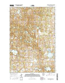
~ Parkers Prairie NW MN topo map, 1:24000 scale, 7.5 X 7.5 Minute, 2016
Parkers Prairie NW, Minnesota, USGS topographic map dated 2016.
Includes geographic coordinates (latitude and longitude). This topographic map is suitable for hiking, camping, and exploring, or framing it as a wall map.
Printed on-demand using high resolution imagery, on heavy weight and acid free paper, or alternatively on a variety of synthetic materials.
Topos available on paper, Waterproof, Poly, or Tyvek. Usually shipping rolled, unless combined with other folded maps in one order.
- Product Number: USGS-8227612
- Free digital map download (high-resolution, GeoPDF): Parkers Prairie NW, Minnesota (file size: 27 MB)
- Map Size: please refer to the dimensions of the GeoPDF map above
- Weight (paper map): ca. 55 grams
- Map Type: POD USGS Topographic Map
- Map Series: US Topo
- Map Verison: Current
- Cell ID: 76600
- Datum: North American Datum of 1983
- Map Projection: Transverse Mercator
- Map Cell Name: Parkers Prairie NW
- Grid size: 7.5 X 7.5 Minute
- Date on map: 2016
- Map Scale: 1:24000
- Geographical region: Minnesota, United States
Neighboring Maps:
All neighboring USGS topo maps are available for sale online at a variety of scales.
Spatial coverage:
Topo map Parkers Prairie NW, Minnesota, covers the geographical area associated the following places:
- North Effington Church - Mud Lake - Perch Lake - Folden Church - Snow Lakes - Lake Sixteen State Wildlife Management Area - Fish Lake - North Effington Cemetery - Block Lake - Effington Post Office (historical) - Almora State Wildlife Management Area - Crogan Lake - Block Lake Dam - Lake Meyer - Township of Folden - Nelson Lake - Lake Sixteen - Folden Cemetery - Township of Effington - Tess Lake - Folden Woods State Wildlife Management Area
- Map Area ID: AREA46.2546.125-95.5-95.375
- Northwest corner Lat/Long code: USGSNW46.25-95.5
- Northeast corner Lat/Long code: USGSNE46.25-95.375
- Southwest corner Lat/Long code: USGSSW46.125-95.5
- Southeast corner Lat/Long code: USGSSE46.125-95.375
- Northern map edge Latitude: 46.25
- Southern map edge Latitude: 46.125
- Western map edge Longitude: -95.5
- Eastern map edge Longitude: -95.375


