
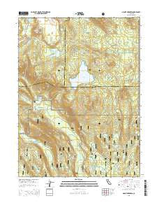
~ Mount Harkness CA topo map, 1:24000 scale, 7.5 X 7.5 Minute, 2015
Mount Harkness, California, USGS topographic map dated 2015.
Includes geographic coordinates (latitude and longitude). This topographic map is suitable for hiking, camping, and exploring, or framing it as a wall map.
Printed on-demand using high resolution imagery, on heavy weight and acid free paper, or alternatively on a variety of synthetic materials.
Topos available on paper, Waterproof, Poly, or Tyvek. Usually shipping rolled, unless combined with other folded maps in one order.
- Product Number: USGS-7981224
- Free digital map download (high-resolution, GeoPDF): Mount Harkness, California (file size: 27 MB)
- Map Size: please refer to the dimensions of the GeoPDF map above
- Weight (paper map): ca. 55 grams
- Map Type: POD USGS Topographic Map
- Map Series: US Topo
- Map Verison: Current
- Cell ID: 30611
- Datum: North American Datum of 1983
- Map Projection: Transverse Mercator
- Map Cell Name: Mount Harkness
- Grid size: 7.5 X 7.5 Minute
- Date on map: 2015
- Map Scale: 1:24000
- Geographical region: California, United States
Neighboring Maps:
All neighboring USGS topo maps are available for sale online at a variety of scales.
Spatial coverage:
Topo map Mount Harkness, California, covers the geographical area associated the following places:
- Crater Butte - Saddle Mountain - East Lake - Lee Camp - Benner Spring - Horseshoe Lake - Bonte Peak - Crystal Lake - Kelly Mountain - Island Lake - Willow Lake - Red Cinder Cone - Indian Lake - Glen Lake - Pilot Mountain - Hidden Lake - Cameron Meadow - Fleischmann Lake - Benner Creek Campground - Swan Lake - Mount Hoffman - Mount Harkness - Warner Valley Census Designated Place - Crater Pool - Bluff Lake - Kings Creek - Hot Springs Creek - Warner Valley Rim - Crystal Cliffs - Domingo Lake - Cameron Meadows - Fleischmann Boy Scout Camp - Jakey Lake - Juniper Lake - Inspiration Point - Kelly Camp - Blue Lake
- Map Area ID: AREA40.540.375-121.375-121.25
- Northwest corner Lat/Long code: USGSNW40.5-121.375
- Northeast corner Lat/Long code: USGSNE40.5-121.25
- Southwest corner Lat/Long code: USGSSW40.375-121.375
- Southeast corner Lat/Long code: USGSSE40.375-121.25
- Northern map edge Latitude: 40.5
- Southern map edge Latitude: 40.375
- Western map edge Longitude: -121.375
- Eastern map edge Longitude: -121.25


