
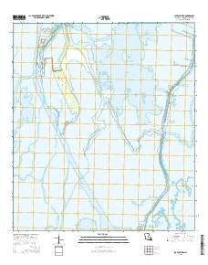
~ Lake Quitman LA topo map, 1:24000 scale, 7.5 X 7.5 Minute, 2015
Lake Quitman, Louisiana, USGS topographic map dated 2015.
Includes geographic coordinates (latitude and longitude). This topographic map is suitable for hiking, camping, and exploring, or framing it as a wall map.
Printed on-demand using high resolution imagery, on heavy weight and acid free paper, or alternatively on a variety of synthetic materials.
Topos available on paper, Waterproof, Poly, or Tyvek. Usually shipping rolled, unless combined with other folded maps in one order.
- Product Number: USGS-7974263
- Free digital map download (high-resolution, GeoPDF): Lake Quitman, Louisiana (file size: 22 MB)
- Map Size: please refer to the dimensions of the GeoPDF map above
- Weight (paper map): ca. 55 grams
- Map Type: POD USGS Topographic Map
- Map Series: US Topo
- Map Verison: Current
- Cell ID: 24630
- Datum: North American Datum of 1983
- Map Projection: Transverse Mercator
- Map Cell Name: Lake Quitman
- Grid size: 7.5 X 7.5 Minute
- Date on map: 2015
- Map Scale: 1:24000
- Geographical region: Louisiana, United States
Neighboring Maps:
All neighboring USGS topo maps are available for sale online at a variety of scales.
Spatial coverage:
Topo map Lake Quitman, Louisiana, covers the geographical area associated the following places:
- Grand Pass Chaland - Cure D'Ars Chapel - Deep Saline Gas Field - Dulac School - Lapeyrouse Oil and Gas Field - Four Point Bayou - Little Caillou Volunteer Fire Department Station 3 - Lapeyrouse Canal - Union Dulac Heliport - Bayou Dulac - Dulac Imco Services Dock Heliport - Bayou Bluff - Rabbit Bayou - Bayou Plat - Sevin Canal - Bayou Petit Caillou - Bayou Cantrelle - Little Pass Chaland - Robinson Canal - Clanton Chapel United Methodist Church - Grassy Bayou - Grand Caillou Volunteer Fire Department - Picou Cemetery - Felix Lake - King Bayou - Sweetwater Pond - Bayou Plat - Deep Saline - Bayou l'Ourse - Wax Bayou - Dulac Bridge - Alligator Bayou - L'eglise de Deju - Houma Terrebonne Heliport - Lake Quitman
- Map Area ID: AREA29.37529.25-90.75-90.625
- Northwest corner Lat/Long code: USGSNW29.375-90.75
- Northeast corner Lat/Long code: USGSNE29.375-90.625
- Southwest corner Lat/Long code: USGSSW29.25-90.75
- Southeast corner Lat/Long code: USGSSE29.25-90.625
- Northern map edge Latitude: 29.375
- Southern map edge Latitude: 29.25
- Western map edge Longitude: -90.75
- Eastern map edge Longitude: -90.625


