
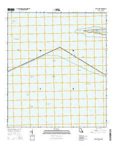
~ Isle au Pitre LA topo map, 1:24000 scale, 7.5 X 7.5 Minute, 2015
Isle au Pitre, Louisiana, USGS topographic map dated 2015.
Includes geographic coordinates (latitude and longitude). This topographic map is suitable for hiking, camping, and exploring, or framing it as a wall map.
Printed on-demand using high resolution imagery, on heavy weight and acid free paper, or alternatively on a variety of synthetic materials.
Topos available on paper, Waterproof, Poly, or Tyvek. Usually shipping rolled, unless combined with other folded maps in one order.
- Product Number: USGS-7974079
- Free digital map download (high-resolution, GeoPDF): Isle au Pitre, Louisiana (file size: 17 MB)
- Map Size: please refer to the dimensions of the GeoPDF map above
- Weight (paper map): ca. 55 grams
- Map Type: POD USGS Topographic Map
- Map Series: US Topo
- Map Verison: Current
- Cell ID: 22165
- Datum: North American Datum of 1983
- Map Projection: Transverse Mercator
- Map Cell Name: Isle au Pitre
- Grid size: 7.5 X 7.5 Minute
- Date on map: 2015
- Map Scale: 1:24000
- Geographical region: Louisiana, United States
Neighboring Maps:
All neighboring USGS topo maps are available for sale online at a variety of scales.
Spatial coverage:
Topo map Isle au Pitre, Louisiana, covers the geographical area associated the following places:
- Little Bayou Pierre - Pass Marianne - South Pass - Fish Tail Flat - Isle au Pitre Bank - Merrill Coquille - Cabbage Reef - Porpoise Shoal - Cat Island Lighthouse (historical) - Merrills Shell Bank Lighthouse - Creole Gap Key - West Point - Pistol Bank - Grand Pass - Isle au Pitre - South Shell Bank Flats - Pelican Key - Tail of the Square Handkerchief Shoal - Creole Gap - Bayou Pierre - Marianne Channel - Potato Hills - North Bank - Cat Island Channel - Shell Bank Channel
- Map Area ID: AREA30.2530.125-89.25-89.125
- Northwest corner Lat/Long code: USGSNW30.25-89.25
- Northeast corner Lat/Long code: USGSNE30.25-89.125
- Southwest corner Lat/Long code: USGSSW30.125-89.25
- Southeast corner Lat/Long code: USGSSE30.125-89.125
- Northern map edge Latitude: 30.25
- Southern map edge Latitude: 30.125
- Western map edge Longitude: -89.25
- Eastern map edge Longitude: -89.125


