
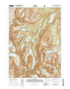
~ Roberts Mountain WY topo map, 1:24000 scale, 7.5 X 7.5 Minute, 2015
Roberts Mountain, Wyoming, USGS topographic map dated 2015.
Includes geographic coordinates (latitude and longitude). This topographic map is suitable for hiking, camping, and exploring, or framing it as a wall map.
Printed on-demand using high resolution imagery, on heavy weight and acid free paper, or alternatively on a variety of synthetic materials.
Topos available on paper, Waterproof, Poly, or Tyvek. Usually shipping rolled, unless combined with other folded maps in one order.
- Product Number: USGS-7862173
- Free digital map download (high-resolution, GeoPDF): Roberts Mountain, Wyoming (file size: 25 MB)
- Map Size: please refer to the dimensions of the GeoPDF map above
- Weight (paper map): ca. 55 grams
- Map Type: POD USGS Topographic Map
- Map Series: US Topo
- Map Verison: Current
- Cell ID: 38142
- Datum: North American Datum of 1983
- Map Projection: Transverse Mercator
- Map Cell Name: Roberts Mountain
- Grid size: 7.5 X 7.5 Minute
- Date on map: 2015
- Map Scale: 1:24000
- Geographical region: Wyoming, United States
Neighboring Maps:
All neighboring USGS topo maps are available for sale online at a variety of scales.
Spatial coverage:
Topo map Roberts Mountain, Wyoming, covers the geographical area associated the following places:
- Twenty Lakes Creek - Wykee Lake - Baily Peak - Lee Lake - Ice Lakes - Spider Lake - Wilson Creek - Middle Fork Lake - Musembeah Peak - Noel Lake - Pronghorn Peak - Mount Lander - Odyssey Peak - Wykee Peak - Entigo Creek - Movo Lake - Roberts Mountain - Glacier Creek - Lake Heebeecheeche - Lake Kagevah - Raft Lake - Saddle Mountain - Wolverine Peak - Wolf Creek - Lake Solitude - Dragon Head Peak - Lake Donna - Nylon Peak - Shelia Lake - Kagevah Peak - Kagevah Pass - Moraine Lake - Roberts Lake - Petroleum Peak - Wind River Roadless Area - Darren Lake - Fremont Trail - Sonnicant Lake - Tepee Pass - Lake Polaris - Trail Lake - Bewmark Lake
- Map Area ID: AREA4342.875-109.375-109.25
- Northwest corner Lat/Long code: USGSNW43-109.375
- Northeast corner Lat/Long code: USGSNE43-109.25
- Southwest corner Lat/Long code: USGSSW42.875-109.375
- Southeast corner Lat/Long code: USGSSE42.875-109.25
- Northern map edge Latitude: 43
- Southern map edge Latitude: 42.875
- Western map edge Longitude: -109.375
- Eastern map edge Longitude: -109.25


