
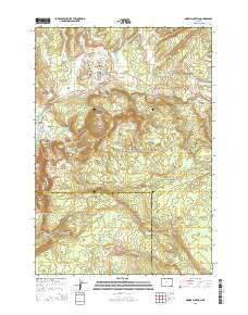
~ Norris Junction WY topo map, 1:24000 scale, 7.5 X 7.5 Minute, 2015
Norris Junction, Wyoming, USGS topographic map dated 2015.
Includes geographic coordinates (latitude and longitude). This topographic map is suitable for hiking, camping, and exploring, or framing it as a wall map.
Printed on-demand using high resolution imagery, on heavy weight and acid free paper, or alternatively on a variety of synthetic materials.
Topos available on paper, Waterproof, Poly, or Tyvek. Usually shipping rolled, unless combined with other folded maps in one order.
- Product Number: USGS-7861265
- Free digital map download (high-resolution, GeoPDF): Norris Junction, Wyoming (file size: 25 MB)
- Map Size: please refer to the dimensions of the GeoPDF map above
- Weight (paper map): ca. 55 grams
- Map Type: POD USGS Topographic Map
- Map Series: US Topo
- Map Verison: Current
- Cell ID: 32295
- Datum: North American Datum of 1983
- Map Projection: Transverse Mercator
- Map Cell Name: Norris Junction
- Grid size: 7.5 X 7.5 Minute
- Date on map: 2015
- Map Scale: 1:24000
- Geographical region: Wyoming, United States
Neighboring Maps:
All neighboring USGS topo maps are available for sale online at a variety of scales.
Spatial coverage:
Topo map Norris Junction, Wyoming, covers the geographical area associated the following places:
- Norris Ranger Station - Gibbon Hill Geyser - Realgar Creek - Nuphar Lake - Porkchop Geyser - Howard Eaton Trail - Crater Hills Geyser - Palpitator Spring - Fearless Geyser - Realgar Spring - Vixen Geyser - Geyser Creek - One Hundred Spring Plain - Elk Park - Cistern Spring - Geyser Springs Group - Echinus Geyser - Valentine Geyser - Congress Pool - Perpetual Spouter - Bathtub Spring - Ice Lake - Paintpot Hill - Pearl Geyser - Hurricane Vent - Norris Geyser Basin - Whirligig Geyser - Steamboat Geyser - Virginia Meadows - Constant Geyser - Monarch Geyser - Scalloped Spring - Artists Paintpots - Gibbon River Rapids - Virginia Cascade - Norris Museum - Sieve Lake - Gibbon Geyser Basin - New Crater Geyser - Big Alcove Spring - Fenner Drill Hole - Realgar Springs - Ice Lakes Trail - Corporal Geyser - Horseshoe Spring - Minute Geyser - Gibbon Hill - Black Growler - Norris Junction - Tantalus Creek - Beryl Spring - Medusa Spring - Emerald Spring - Gray Lakes - Phillips Caldron - Chocolate Pots - Duck Rock - Solfatara Creek
- Map Area ID: AREA44.7544.625-110.75-110.625
- Northwest corner Lat/Long code: USGSNW44.75-110.75
- Northeast corner Lat/Long code: USGSNE44.75-110.625
- Southwest corner Lat/Long code: USGSSW44.625-110.75
- Southeast corner Lat/Long code: USGSSE44.625-110.625
- Northern map edge Latitude: 44.75
- Southern map edge Latitude: 44.625
- Western map edge Longitude: -110.75
- Eastern map edge Longitude: -110.625


