
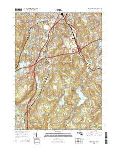
~ Worcester South MA topo map, 1:24000 scale, 7.5 X 7.5 Minute, 2015
Worcester South, Massachusetts, USGS topographic map dated 2015.
Includes geographic coordinates (latitude and longitude). This topographic map is suitable for hiking, camping, and exploring, or framing it as a wall map.
Printed on-demand using high resolution imagery, on heavy weight and acid free paper, or alternatively on a variety of synthetic materials.
Topos available on paper, Waterproof, Poly, or Tyvek. Usually shipping rolled, unless combined with other folded maps in one order.
- Product Number: USGS-7842809
- Free digital map download (high-resolution, GeoPDF): Worcester South, Massachusetts (file size: 27 MB)
- Map Size: please refer to the dimensions of the GeoPDF map above
- Weight (paper map): ca. 55 grams
- Map Type: POD USGS Topographic Map
- Map Series: US Topo
- Map Verison: Current
- Cell ID: 49873
- Datum: North American Datum of 1983
- Map Projection: Transverse Mercator
- Map Cell Name: Worcester South
- Grid size: 7.5 X 7.5 Minute
- Date on map: 2015
- Map Scale: 1:24000
- Geographical region: Massachusetts, United States
Neighboring Maps:
All neighboring USGS topo maps are available for sale online at a variety of scales.
Spatial coverage:
Topo map Worcester South, Massachusetts, covers the geographical area associated the following places:
- Marions Camp - Dorothy Manor - Cambridge - Vernon Hill - Webster Square - Ludlow - Drury Square - Old Common - Dorothy Pond - Bramanville - College Hill - New Worcester (historical) - Woodland Park - Valley Falls (historical) - Massasoit - Jamesville - Stoneville - Pondville - Pakachoag - Heard Street - South Worcester - Windbrook Acres Mobile Home Park - Sutton - West Auburn - Cherry Valley - Jamesville (historical) - Island - Rice Square - Sunderland - Auburn - Quinsigamond Village - Millbury - Trowbridgeville (historical) - South Grafton Street - North Oxford - West Millbury - Whispering Pines Estates Mobile Home Park - Oakland Heights
- Map Area ID: AREA42.2542.125-71.875-71.75
- Northwest corner Lat/Long code: USGSNW42.25-71.875
- Northeast corner Lat/Long code: USGSNE42.25-71.75
- Southwest corner Lat/Long code: USGSSW42.125-71.875
- Southeast corner Lat/Long code: USGSSE42.125-71.75
- Northern map edge Latitude: 42.25
- Southern map edge Latitude: 42.125
- Western map edge Longitude: -71.875
- Eastern map edge Longitude: -71.75


