
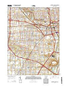
~ Southwest Columbus OH topo map, 1:24000 scale, 7.5 X 7.5 Minute, Historical, 2013
Southwest Columbus, Ohio, USGS topographic map dated 2013.
Includes geographic coordinates (latitude and longitude). This topographic map is suitable for hiking, camping, and exploring, or framing it as a wall map.
Printed on-demand using high resolution imagery, on heavy weight and acid free paper, or alternatively on a variety of synthetic materials.
Topos available on paper, Waterproof, Poly, or Tyvek. Usually shipping rolled, unless combined with other folded maps in one order.
- Product Number: USGS-7829825
- Free digital map download (high-resolution, GeoPDF): Southwest Columbus, Ohio (file size: 36 MB)
- Map Size: please refer to the dimensions of the GeoPDF map above
- Weight (paper map): ca. 55 grams
- Map Type: POD USGS Topographic Map
- Map Series: US Topo
- Map Verison: Historical
- Cell ID: 42352
- Datum: North American Datum of 1983
- Map Projection: Transverse Mercator
- Map Cell Name: Southwest Columbus
- Grid size: 7.5 X 7.5 Minute
- Date on map: 2013
- Map Scale: 1:24000
- Geographical region: Ohio, United States
Neighboring Maps:
All neighboring USGS topo maps are available for sale online at a variety of scales.
Spatial coverage:
Topo map Southwest Columbus, Ohio, covers the geographical area associated the following places:
- Parlin Manor - Alkire Place - Heritage Glen - La Rosa - Parkside Estates - Kingswood Heights - Briggsdale - Oak Grove - Concord Park - Sherry Lynne Homes - Elginfield - Concord Lakes - Highland Park - Jackson Homes - Farmbrook - Parkside Village - Brook Park - Grandview Heights - San Margherita - Pine Grove - Grove City Heights - West Grove North - Alkire Lakes - High Meadow - Urbancrest - Brookgrove - Hidden Meadows - Holt Park - Park Ridge - Valley View - Pine Manor - Marble Cliff - West Grove - Sullivants (historical) - Upper Arlington - Alkire Run - Monterey Park - Rush Creek - Alkire Village - Woodlawn Addition - Barfield Heights - Grove City - Alkire Woods - Tanglebrook - Walden Bluffs - Deems (historical)
- Map Area ID: AREA4039.875-83.125-83
- Northwest corner Lat/Long code: USGSNW40-83.125
- Northeast corner Lat/Long code: USGSNE40-83
- Southwest corner Lat/Long code: USGSSW39.875-83.125
- Southeast corner Lat/Long code: USGSSE39.875-83
- Northern map edge Latitude: 40
- Southern map edge Latitude: 39.875
- Western map edge Longitude: -83.125
- Eastern map edge Longitude: -83


