
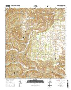
~ Woodson Canyon NM topo map, 1:24000 scale, 7.5 X 7.5 Minute, Historical, 2013
Woodson Canyon, New Mexico, USGS topographic map dated 2013.
Includes geographic coordinates (latitude and longitude). This topographic map is suitable for hiking, camping, and exploring, or framing it as a wall map.
Printed on-demand using high resolution imagery, on heavy weight and acid free paper, or alternatively on a variety of synthetic materials.
Topos available on paper, Waterproof, Poly, or Tyvek. Usually shipping rolled, unless combined with other folded maps in one order.
- Product Number: USGS-7796816
- Free digital map download (high-resolution, GeoPDF): Woodson Canyon, New Mexico (file size: 35 MB)
- Map Size: please refer to the dimensions of the GeoPDF map above
- Weight (paper map): ca. 55 grams
- Map Type: POD USGS Topographic Map
- Map Series: US Topo
- Map Verison: Historical
- Cell ID: 49819
- Datum: North American Datum of 1983
- Map Projection: Transverse Mercator
- Map Cell Name: Woodson Canyon
- Grid size: 7.5 X 7.5 Minute
- Date on map: 2013
- Map Scale: 1:24000
- Geographical region: New Mexico, United States
Neighboring Maps:
All neighboring USGS topo maps are available for sale online at a variety of scales.
Spatial coverage:
Topo map Woodson Canyon, New Mexico, covers the geographical area associated the following places:
- Stephens Tanks - Reilsplitter Tank Number Three - Dela Van Lake - Snow Tank - McDonald Flat - Hackberry Lake - Snow Canyon - McDonald Lake - Dougherty Well - Lower Snow Tank - CCC Tank - Little Tank - Key Tank - Bud Holland Canyon - Section Eleven Tank - Miller Flats - Woodson Canyon - Ernest Well - Covel Lake - Middle Tank - Rock Draw Tank - Allen Lake - Prather Canyon - Little Tank - Perk Canyon - Hunter Canyon - Graveyard Tank - McEwan Canyon - Bluewater Canyon - Schoolhouse Tank - Cantwell Lake - Barkley Lake - Bell Tank - Section 24 Tank - Wilson Lake - Stephens Well - Graveyard Canyon - Miller Well - Lewis Ranch - Prather Tank - Flume Canyon - Lusk Cemetery - Bible Canyon - Rock Tank Canyon - Railsplitter Tank Number Two
- Map Area ID: AREA32.87532.75-105.5-105.375
- Northwest corner Lat/Long code: USGSNW32.875-105.5
- Northeast corner Lat/Long code: USGSNE32.875-105.375
- Southwest corner Lat/Long code: USGSSW32.75-105.5
- Southeast corner Lat/Long code: USGSSE32.75-105.375
- Northern map edge Latitude: 32.875
- Southern map edge Latitude: 32.75
- Western map edge Longitude: -105.5
- Eastern map edge Longitude: -105.375


