
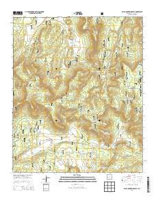
~ Gallo Mountains East NM topo map, 1:24000 scale, 7.5 X 7.5 Minute, Historical, 2013
Gallo Mountains East, New Mexico, USGS topographic map dated 2013.
Includes geographic coordinates (latitude and longitude). This topographic map is suitable for hiking, camping, and exploring, or framing it as a wall map.
Printed on-demand using high resolution imagery, on heavy weight and acid free paper, or alternatively on a variety of synthetic materials.
Topos available on paper, Waterproof, Poly, or Tyvek. Usually shipping rolled, unless combined with other folded maps in one order.
- Product Number: USGS-7792378
- Free digital map download (high-resolution, GeoPDF): Gallo Mountains East, New Mexico (file size: 38 MB)
- Map Size: please refer to the dimensions of the GeoPDF map above
- Weight (paper map): ca. 55 grams
- Map Type: POD USGS Topographic Map
- Map Series: US Topo
- Map Verison: Historical
- Cell ID: 16712
- Datum: North American Datum of 1983
- Map Projection: Transverse Mercator
- Map Cell Name: Gallo Mountains East
- Grid size: 7.5 X 7.5 Minute
- Date on map: 2013
- Map Scale: 1:24000
- Geographical region: New Mexico, United States
Neighboring Maps:
All neighboring USGS topo maps are available for sale online at a variety of scales.
Spatial coverage:
Topo map Gallo Mountains East, New Mexico, covers the geographical area associated the following places:
- Waterdog Tank - Shallow Tank - Old State Tank - Bog Tank - Telephone Tank - Armijo Spring - Gallo Lake - Telephone Canyon - Willow Spring - Ambrosia Tank - Malpais Spring - Sawmill Windmill - Tule Lake - Hog Back Pit Tank - Windy Tank - Bull Camp Pit Tank - Gallo Tank - Willow Creek - First Windmill - Campground Spring - Hook Tank - Preference Tank - Gallo Mountains - Davis Windmill - White Rock Lake - Frank Spring - Porcupine Spring - East Tank - Road Tanks - Bull Camp Spring - Gallita Canyon - Pueblo Spring - Bull Camp - Costilla Spring - Crater Tank - Trough Spring - Sawmill Camp Trail - Route Spring - Acorn Tank - Armijo Tank - Agua Fria Tank - Gibbs Tank - Rim Spring - Gallita Spring - Armijo Campground - Porcupine Canyon
- Map Area ID: AREA34.12534-108.625-108.5
- Northwest corner Lat/Long code: USGSNW34.125-108.625
- Northeast corner Lat/Long code: USGSNE34.125-108.5
- Southwest corner Lat/Long code: USGSSW34-108.625
- Southeast corner Lat/Long code: USGSSE34-108.5
- Northern map edge Latitude: 34.125
- Southern map edge Latitude: 34
- Western map edge Longitude: -108.625
- Eastern map edge Longitude: -108.5


