
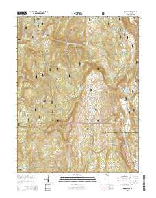
~ Woods Lake UT topo map, 1:24000 scale, 7.5 X 7.5 Minute, Current, 2014
Woods Lake, Utah, USGS topographic map dated 2014.
Includes geographic coordinates (latitude and longitude). This topographic map is suitable for hiking, camping, and exploring, or framing it as a wall map.
Printed on-demand using high resolution imagery, on heavy weight and acid free paper, or alternatively on a variety of synthetic materials.
Topos available on paper, Waterproof, Poly, or Tyvek. Usually shipping rolled, unless combined with other folded maps in one order.
- Product Number: USGS-7789766
- Free digital map download (high-resolution, GeoPDF): Woods Lake, Utah (file size: 36 MB)
- Map Size: please refer to the dimensions of the GeoPDF map above
- Weight (paper map): ca. 55 grams
- Map Type: POD USGS Topographic Map
- Map Series: US Topo
- Map Verison: Current
- Cell ID: 49805
- Datum: North American Datum of 1983
- Map Projection: Transverse Mercator
- Map Cell Name: Woods Lake
- Grid size: 7.5 X 7.5 Minute
- Date on map: 2014
- Map Scale: 1:24000
- Geographical region: Utah, United States
Neighboring Maps:
All neighboring USGS topo maps are available for sale online at a variety of scales.
Spatial coverage:
Topo map Woods Lake, Utah, covers the geographical area associated the following places:
- Island Lake - Deep Lake Dam - Woods Lake - Porcupine Knoll - Gunnison Valley - Red Pine Canyon - Pinchot Campground - Porcupine Ridge - Cooley Creek - South Willow Creek Fork - South Fork Twelvemile Creek - Deep Lake - Jump Creek - Twin Lake - Cow Canyon - Beaver Creek - Mill Fork Creek - W P A Ponds - Balsam Grove Ridge - Quaking Asp Hollow - Slide Lake - Baseball Flat - Twin Lake Dam - Narrows Valley - Whitlock Cabin - Musinea Administrative Site - Clear Creek Flats - Spruce Spring - Three Lakes - Marys Nipple - Cowboy Camp - Step Flats - Nipple Ridge - Blue Lake - Birch Creek
- Map Area ID: AREA39.12539-111.625-111.5
- Northwest corner Lat/Long code: USGSNW39.125-111.625
- Northeast corner Lat/Long code: USGSNE39.125-111.5
- Southwest corner Lat/Long code: USGSSW39-111.625
- Southeast corner Lat/Long code: USGSSE39-111.5
- Northern map edge Latitude: 39.125
- Southern map edge Latitude: 39
- Western map edge Longitude: -111.625
- Eastern map edge Longitude: -111.5


