
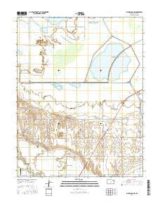
~ Ellinwood NW KS topo map, 1:24000 scale, 7.5 X 7.5 Minute, 2016
Ellinwood NW, Kansas, USGS topographic map dated 2016.
Includes geographic coordinates (latitude and longitude). This topographic map is suitable for hiking, camping, and exploring, or framing it as a wall map.
Printed on-demand using high resolution imagery, on heavy weight and acid free paper, or alternatively on a variety of synthetic materials.
Topos available on paper, Waterproof, Poly, or Tyvek. Usually shipping rolled, unless combined with other folded maps in one order.
- Product Number: USGS-7730351
- Free digital map download (high-resolution, GeoPDF): Ellinwood NW, Kansas (file size: 21 MB)
- Map Size: please refer to the dimensions of the GeoPDF map above
- Weight (paper map): ca. 55 grams
- Map Type: POD USGS Topographic Map
- Map Series: US Topo
- Map Verison: Current
- Cell ID: 14112
- Datum: North American Datum of 1983
- Map Projection: Transverse Mercator
- Map Cell Name: Ellinwood NW
- Grid size: 7.5 X 7.5 Minute
- Date on map: 2016
- Map Scale: 1:24000
- Geographical region: Kansas, United States
Neighboring Maps:
All neighboring USGS topo maps are available for sale online at a variety of scales.
Spatial coverage:
Topo map Ellinwood NW, Kansas, covers the geographical area associated the following places:
- Barton Community College - L Building - Barton Community College - C Building - Cheyenne Bottoms - Barton Community College Child Development Center - Barton Community College Kirkman Student Activity Center - Barton Community College - S Building - Barton Community College - P Building - Pool 3A - Pool 3B - Barton Community College - A Building - Pool 2 - Dry Walnut Creek - Barton Community College Planetarium - Cheyenne View School - Barton Community College - T Building - Cheyenne Bottoms Wildlife Area - Pool 1B - Township of Great Bend - Pool 1C - Community Christian Church - Barton Community College - U Building - Button Airport - L E Gus and Eva Shafer Memorial Art Gallery - Fort Hays State University Kansas Wetlands Education Center - KBJC-FM (Great Bend) - Barton County Community College - Fort Zarah (historical) - Pool 5 - Pool 1A - Barton County Community College Water Treatment Facility - Barton County Landfill - Barton Community College - F Building - Blood Creek
- Map Area ID: AREA38.538.375-98.75-98.625
- Northwest corner Lat/Long code: USGSNW38.5-98.75
- Northeast corner Lat/Long code: USGSNE38.5-98.625
- Southwest corner Lat/Long code: USGSSW38.375-98.75
- Southeast corner Lat/Long code: USGSSE38.375-98.625
- Northern map edge Latitude: 38.5
- Southern map edge Latitude: 38.375
- Western map edge Longitude: -98.75
- Eastern map edge Longitude: -98.625


