
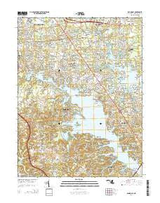
~ Round Bay MD topo map, 1:24000 scale, 7.5 X 7.5 Minute, Historical, 2014
Round Bay, Maryland, USGS topographic map dated 2014.
Includes geographic coordinates (latitude and longitude). This topographic map is suitable for hiking, camping, and exploring, or framing it as a wall map.
Printed on-demand using high resolution imagery, on heavy weight and acid free paper, or alternatively on a variety of synthetic materials.
Topos available on paper, Waterproof, Poly, or Tyvek. Usually shipping rolled, unless combined with other folded maps in one order.
- Product Number: USGS-7692850
- Free digital map download (high-resolution, GeoPDF): Round Bay, Maryland (file size: 40 MB)
- Map Size: please refer to the dimensions of the GeoPDF map above
- Weight (paper map): ca. 55 grams
- Map Type: POD USGS Topographic Map
- Map Series: US Topo
- Map Verison: Historical
- Cell ID: 38725
- Datum: North American Datum of 1983
- Map Projection: Transverse Mercator
- Map Cell Name: Round Bay
- Grid size: 7.5 X 7.5 Minute
- Date on map: 2014
- Map Scale: 1:24000
- Geographical region: Maryland, United States
Neighboring Maps:
All neighboring USGS topo maps are available for sale online at a variety of scales.
Spatial coverage:
Topo map Round Bay, Maryland, covers the geographical area associated the following places:
- Harting Estates - Oaks of Severna Park - Deerfield - Beachwood Forest - Point Field Landing on the Severn - Jones - Robin Hood Hill - Pohlman Point - Indian Landing Estates - Riverdale - Chartridge - Asberry (historical) - Fair Winds - North Cape Arthur - Round Bay - Ben Oaks - Stewarts Landing - Cool Pond - Capri Estates - Hidden Hills - Riverdale Forest - Chatham Hills - Carrollton Manor - Brookfield on the Magothy - The Dales - Oak Hollow - Magothy Forge - Evergreen Estates - Marabrooke - Lakeland - Holly Point - Sherwood Forest - Cape Sable - Seaborne Estates - Oak Landing - Laurel Acres - Longmeadow North - Selby Grove - Royal Beach - Ravenshead - Severn Heights - Beachwood Grove - Benfield - Woytych - Brightwood - Gotts - Saltworks on the Severn - Summer Hill Trailer Park - Hollywood - Epping Farms - Mago Vista Beach - Magothy Beach - Cranberry Woods - Severn Landing - Downs on the Severn - Oak Grove - Indian Village - Saefern - Glen Oban - Maceys Corner - Harbor Oaks - Sabrina Park - Quail Run - Watson Place - Fairoaks - Old Severna Park - Omar (historical) - Evans Hill - Pasadena Manor - Arundel Beach - College Hills - The Woods - Duffield - Jennings - Tall Timbers - Magothy Forest - Elvaton - College Manor - Linstead-on-the-Severn - Trinity Farms - Chartwell - Epping Forest - Bluff Point - Chelsea Pines - Revell - Dunstable Green - Elvaton Acres - Briar Cliff on the Severn - Belleview Estates - Wexford - Bancroft - Sun Set Knoll - Drexel Estates - Whitneys Landing - Hampton Manor - Joyce Acres - Ashcroft - Farish Farms - Moorings on the Magothy - Crownsville
- Map Area ID: AREA39.12539-76.625-76.5
- Northwest corner Lat/Long code: USGSNW39.125-76.625
- Northeast corner Lat/Long code: USGSNE39.125-76.5
- Southwest corner Lat/Long code: USGSSW39-76.625
- Southeast corner Lat/Long code: USGSSE39-76.5
- Northern map edge Latitude: 39.125
- Southern map edge Latitude: 39
- Western map edge Longitude: -76.625
- Eastern map edge Longitude: -76.5


