
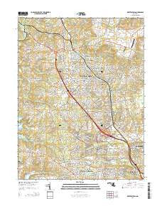
~ Reisterstown MD topo map, 1:24000 scale, 7.5 X 7.5 Minute, Historical, 2014
Reisterstown, Maryland, USGS topographic map dated 2014.
Includes geographic coordinates (latitude and longitude). This topographic map is suitable for hiking, camping, and exploring, or framing it as a wall map.
Printed on-demand using high resolution imagery, on heavy weight and acid free paper, or alternatively on a variety of synthetic materials.
Topos available on paper, Waterproof, Poly, or Tyvek. Usually shipping rolled, unless combined with other folded maps in one order.
- Product Number: USGS-7692832
- Free digital map download (high-resolution, GeoPDF): Reisterstown, Maryland (file size: 37 MB)
- Map Size: please refer to the dimensions of the GeoPDF map above
- Weight (paper map): ca. 55 grams
- Map Type: POD USGS Topographic Map
- Map Series: US Topo
- Map Verison: Historical
- Cell ID: 37580
- Datum: North American Datum of 1983
- Map Projection: Transverse Mercator
- Map Cell Name: Reisterstown
- Grid size: 7.5 X 7.5 Minute
- Date on map: 2014
- Map Scale: 1:24000
- Geographical region: Maryland, United States
Neighboring Maps:
All neighboring USGS topo maps are available for sale online at a variety of scales.
Spatial coverage:
Topo map Reisterstown, Maryland, covers the geographical area associated the following places:
- Deer Park - Cedarmere - Worthington Park - Imperial Gardens - Rolling Ridge - Stoneybrook North - Hunters Glen - Norris Run Woods - Hunters Glen South - Worthington - Woodglen Farms - Sunnybrook Farms - The Meadows - Cave Valley - Crandon - Olde Mill Estates - Hickory Hill Estates - Pleasant Hill - McDonogh - Hewitt Farms - Morningside Heights - Arborwood - Holbrook - Academy Lane - Westbury - Woodleaf - Suburbia - Garrison Ridge - Mount Wilson - Harrisonville - Worthington Run - Owings Ridge - Dunbar - Foxridge - Emory Grove - Lyonswood - Saint Georges - Julian Woods - Belltown - Falcon Ridge - Wildwoods - Deer Cross - Twelve Trees - Reservoir Ridge - Woodlands - Green Spring Junction - Glen Morris - Gunrich (historical) - Franklin Valley - Allyson Gardens - Tree Top Station - McDonogh Park - Glyndon - Tobin - Velvet Hills South - Village of Timber Grove - Delight - Cherry Valley - Glen Falls - Glyndon Greens - Silverbrook Farm - Winands Valley Estates - Worthington Meadows - Tollgate - Chartley - Worthington Glen - McDonogh Manor - Gwynnbrook - Tyler - Nob Hill - Sagamore Forest - Green Hill Farm - Fox Haven Estates - Valley Hills - Velvet Hills - Sagamore Village - Timber Grove - Sarawoods - Timber Chase - Village of Painters Mill - The Chase at Foxridge - Owings Mills - Academy Acres - Worthington Place South - Whispering Meadows - Kendig Mill Station - Ivy Meadows - Hernwood Heights - Reisterstown - Garrison Forest - The Manors - Hathaway - Garrison - Delight Meadows
- Map Area ID: AREA39.539.375-76.875-76.75
- Northwest corner Lat/Long code: USGSNW39.5-76.875
- Northeast corner Lat/Long code: USGSNE39.5-76.75
- Southwest corner Lat/Long code: USGSSW39.375-76.875
- Southeast corner Lat/Long code: USGSSE39.375-76.75
- Northern map edge Latitude: 39.5
- Southern map edge Latitude: 39.375
- Western map edge Longitude: -76.875
- Eastern map edge Longitude: -76.75


