
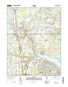
~ Selbyville DE topo map, 1:24000 scale, 7.5 X 7.5 Minute, Historical, 2014
Selbyville, Delaware, USGS topographic map dated 2014.
Includes geographic coordinates (latitude and longitude). This topographic map is suitable for hiking, camping, and exploring, or framing it as a wall map.
Printed on-demand using high resolution imagery, on heavy weight and acid free paper, or alternatively on a variety of synthetic materials.
Topos available on paper, Waterproof, Poly, or Tyvek. Usually shipping rolled, unless combined with other folded maps in one order.
- Product Number: USGS-7692200
- Free digital map download (high-resolution, GeoPDF): Selbyville, Delaware (file size: 38 MB)
- Map Size: please refer to the dimensions of the GeoPDF map above
- Weight (paper map): ca. 55 grams
- Map Type: POD USGS Topographic Map
- Map Series: US Topo
- Map Verison: Historical
- Cell ID: 40484
- Datum: North American Datum of 1983
- Map Projection: Transverse Mercator
- Map Cell Name: Selbyville
- Grid size: 7.5 X 7.5 Minute
- Date on map: 2014
- Map Scale: 1:24000
- Geographical region: Delaware, United States
Neighboring Maps:
All neighboring USGS topo maps are available for sale online at a variety of scales.
Spatial coverage:
Topo map Selbyville, Delaware, covers the geographical area associated the following places:
- Mumfords Landing - Pepper Ridge Mobile Home Park - Little Georgetown - Saint Martins by the Bay - Tanglewood - Selbyville - Bishopville - Fenwick Estates - Bainbridge - Bishop - Piney Island - Lantern Lane Mobile Villa - Smithfield Acres - Newport - Huntington - Holiday Harbor - North Ocean Pines - Manklin Moorings - Johnson - Bay View Estates - Campbell - Cape Pleasant - Pintail Isle - Hudson Crossroads - Shingle Landing - Bramblewood - Roxana - Beachwood - Nantucket - Spring Brook Forest - Somerset - Teal Bay - Holiday Manor - Manklin Meadows - Ocean Pines - Louis Heights - Seabright - Parkertown - Douglynn Farms - Showell - Williamsville - South Ocean Pines - Pinehurst - Bay Colony - Bunting - Piney Point
- Map Area ID: AREA38.538.375-75.25-75.125
- Northwest corner Lat/Long code: USGSNW38.5-75.25
- Northeast corner Lat/Long code: USGSNE38.5-75.125
- Southwest corner Lat/Long code: USGSSW38.375-75.25
- Southeast corner Lat/Long code: USGSSE38.375-75.125
- Northern map edge Latitude: 38.5
- Southern map edge Latitude: 38.375
- Western map edge Longitude: -75.25
- Eastern map edge Longitude: -75.125


