
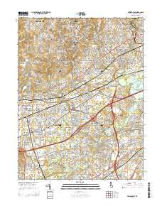
~ Newark East DE topo map, 1:24000 scale, 7.5 X 7.5 Minute, Historical, 2014
Newark East, Delaware, USGS topographic map dated 2014.
Includes geographic coordinates (latitude and longitude). This topographic map is suitable for hiking, camping, and exploring, or framing it as a wall map.
Printed on-demand using high resolution imagery, on heavy weight and acid free paper, or alternatively on a variety of synthetic materials.
Topos available on paper, Waterproof, Poly, or Tyvek. Usually shipping rolled, unless combined with other folded maps in one order.
- Product Number: USGS-7692190
- Free digital map download (high-resolution, GeoPDF): Newark East, Delaware (file size: 39 MB)
- Map Size: please refer to the dimensions of the GeoPDF map above
- Weight (paper map): ca. 55 grams
- Map Type: POD USGS Topographic Map
- Map Series: US Topo
- Map Verison: Historical
- Cell ID: 31899
- Datum: North American Datum of 1983
- Map Projection: Transverse Mercator
- Map Cell Name: Newark East
- Grid size: 7.5 X 7.5 Minute
- Date on map: 2014
- Map Scale: 1:24000
- Geographical region: Delaware, United States
Neighboring Maps:
All neighboring USGS topo maps are available for sale online at a variety of scales.
Spatial coverage:
Topo map Newark East, Delaware, covers the geographical area associated the following places:
- Kiamensi - Windy Hills - Brookbend - Wedgewood - Lumbrook - Red Mills Farms - Limestone Gardene - Lakecroft II - Brandywine Springs - Melanie - Delpark Manor - Pine Swamp Corner - Meadowood - Edgebrooke - Piermont Woods - Iron Hills Apartments - Carousel Knoll - Centennial Village - Hillside Heights - Pennock - Sycamore Gardens - Cedars - Newkirk Estates - Coventry - The Pines of Pike Creek - Wilson - Princeton Wood II - Yorkshire - Kirkwood Gardens - Pleasant Hill - Redmont - Milford Crossroads - Glenville - Pencader - Stones Throw - Albertson Park - Faulkland - Rutherford - Duross Heights - Linden Green Apartment - Birch Pointe - Eastburn Acres - Milford Meadows - Breezewood II - Parkwood - Deer Run - Marydale - Jamestowne - Birchwood Park - Cavaliers Country Club Apartments - Taylortown - Sheffield Manor - Varlano - Pinecrest - Coach Hill - Sheridan Square - Cedar Farms - Salem Woods - Montclare - Faulkland Woods - Skyline Ridge - Drummond North - Limestone Gap - Linden Square - Bear - Mermaid Run - Greenbank - Duncan Woods - Windy Hills - Victoria Woods - Sherwood Park - The Village of Drummond Hill - Milltown - Delaplane Manor - Newark - Old Mill Manor - Limestone Acres - Rolling Hills - Lindell Village - Beechers Lot - Maplecrest - Albertson - Stage Road Development - Stones Throw - Pepper Ridge - Robscott Manor - Corner Ketch - Christiana - Todd Estates - Marshallton Green - Woodcreek - Marshallton - Pigeon Run - Ogletown - English Village - Brookhaven - Albion - Plum Run - Fairway Falls - Heritage Farms
- Map Area ID: AREA39.7539.625-75.75-75.625
- Northwest corner Lat/Long code: USGSNW39.75-75.75
- Northeast corner Lat/Long code: USGSNE39.75-75.625
- Southwest corner Lat/Long code: USGSSW39.625-75.75
- Southeast corner Lat/Long code: USGSSE39.625-75.625
- Northern map edge Latitude: 39.75
- Southern map edge Latitude: 39.625
- Western map edge Longitude: -75.75
- Eastern map edge Longitude: -75.625


