
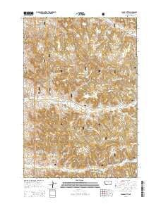
~ Yager Butte MT topo map, 1:24000 scale, 7.5 X 7.5 Minute, Current, 2014
Yager Butte, Montana, USGS topographic map dated 2014.
Includes geographic coordinates (latitude and longitude). This topographic map is suitable for hiking, camping, and exploring, or framing it as a wall map.
Printed on-demand using high resolution imagery, on heavy weight and acid free paper, or alternatively on a variety of synthetic materials.
Topos available on paper, Waterproof, Poly, or Tyvek. Usually shipping rolled, unless combined with other folded maps in one order.
- Product Number: USGS-7598946
- Free digital map download (high-resolution, GeoPDF): Yager Butte, Montana (file size: 37 MB)
- Map Size: please refer to the dimensions of the GeoPDF map above
- Weight (paper map): ca. 55 grams
- Map Type: POD USGS Topographic Map
- Map Series: US Topo
- Map Verison: Current
- Cell ID: 50004
- Datum: North American Datum of 1983
- Map Projection: Transverse Mercator
- Map Cell Name: Yager Butte
- Grid size: 7.5 X 7.5 Minute
- Date on map: 2014
- Map Scale: 1:24000
- Geographical region: Montana, United States
Neighboring Maps:
All neighboring USGS topo maps are available for sale online at a variety of scales.
Spatial coverage:
Topo map Yager Butte, Montana, covers the geographical area associated the following places:
- McLatchy Reservoir - 05S46E03CADC01 Well - Yager Gulch - Coal Creek - 05S46E05BDCB01 Well - 05S46E29ABAA01 Well - 05S46020ABCA01 Spring - 05S46E09DADD01 Spring - Watt Draw Spring - Yager Well - 05S46E20ABCA01 Well - 04S46E34ABDB01 Spring - 05S46E04DACA01 Well - Nutter Well - 05S46E24BCCB01 Well - Cloudburst Reservoir - Ottesen Spring - 05S46E04DDAB01 Well - 04S46E28DABC01 Spring - Nutter Draw - DD Spring - 05S46E20CDAB02 Well - Coal Creek Spring - Shorty Ridge Reservoir - Fifteenmile Reservoir Number Two - Willey Use Spring - Newcomer Spring - Fortune Spring - Two Buck Reservoir - 04S46E33CBAC01 Well - 04S46E29CBBA01 Spring - 04S46E31CCCC01 Well - Harriet Spring Number Two - Shorty Creek Reservoir - Yager Creek - North Fork Yager Creek - 04S46E32DCDC01 Well - Fifteenmile Reservoir Number One - 05S46E23CBDD01 Well - Middle Fork Tenmile Creek - Fifteenmile Spring - Harriet Spring Number One - 05S46E23CACA01 Well - 05S46E24BCCB02 Well - Shorty Ridge Well - Mineral Yager Spring - 04S46E10DABC01 Well - 04S46E15CBDC01 Well - Yager Butte - Plum Creek - Chimney Rock - Howard Reservoir - Spike Camp Spring - Custer National Forest - Ashland Division - 05S46E20CDAB03 Well - Erickson Reservoir - Erickson Spring - McBride Spring - Smith Spring - 04S46E31DDBC01 Well - 05S46E28BBAB01 Well - 05S46E21DDAA01 Well - McLatchy Draw Well - Coombe Spring - 04S46E28DADC01 Spring - 04S46E36BCDA01 Spring - Dam Creek Reservoir - 04S46E08CBCC01 Well - 05S46E20CDAB01 Well - Jacobs Gulch - 05S46E27BAAA01 Spring - Softwater Spring
- Map Area ID: AREA45.545.375-106.125-106
- Northwest corner Lat/Long code: USGSNW45.5-106.125
- Northeast corner Lat/Long code: USGSNE45.5-106
- Southwest corner Lat/Long code: USGSSW45.375-106.125
- Southeast corner Lat/Long code: USGSSE45.375-106
- Northern map edge Latitude: 45.5
- Southern map edge Latitude: 45.375
- Western map edge Longitude: -106.125
- Eastern map edge Longitude: -106


