
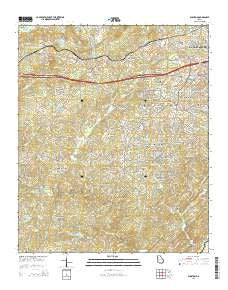
~ Winston GA topo map, 1:24000 scale, 7.5 X 7.5 Minute, Current, 2014
Winston, Georgia, USGS topographic map dated 2014.
Includes geographic coordinates (latitude and longitude). This topographic map is suitable for hiking, camping, and exploring, or framing it as a wall map.
Printed on-demand using high resolution imagery, on heavy weight and acid free paper, or alternatively on a variety of synthetic materials.
Topos available on paper, Waterproof, Poly, or Tyvek. Usually shipping rolled, unless combined with other folded maps in one order.
- Product Number: USGS-7537513
- Free digital map download (high-resolution, GeoPDF): Winston, Georgia (file size: 39 MB)
- Map Size: please refer to the dimensions of the GeoPDF map above
- Weight (paper map): ca. 55 grams
- Map Type: POD USGS Topographic Map
- Map Series: US Topo
- Map Verison: Current
- Cell ID: 49537
- Datum: North American Datum of 1983
- Map Projection: Transverse Mercator
- Map Cell Name: Winston
- Grid size: 7.5 X 7.5 Minute
- Date on map: 2014
- Map Scale: 1:24000
- Geographical region: Georgia, United States
Neighboring Maps:
All neighboring USGS topo maps are available for sale online at a variety of scales.
Spatial coverage:
Topo map Winston, Georgia, covers the geographical area associated the following places:
- Kings West - Gregory Heights - Sugar Creek - Worthington Estates - Woods Valley - Sherrian Estates - White Oak Estates - Cowan Mill Estates - Blain Woods - Bent Pine - Ephesus Heights - Executive Heights - Aberdeen Estates - Imperial Estates - The Oaks - Bright Star - Montage Manor - Oakdale Estates - Fouts Mill - Johnson Land - Kings Point - Coronado Forest - Stewart Mill Acres - Daniell Mill Estates - Laurel Heights - Audubon Forest - Seminole Valley - Winston - Mill Glen - West Lake - Goodwindy Estates - Glen Ridge - Shallowford Heights - Sweetwater Bluff - Aline Estates - Twin Pine Estates - White City - Douglas Ridge - Bear Creek Estates - The Noles Estates - Orchard Park
- Map Area ID: AREA33.7533.625-84.875-84.75
- Northwest corner Lat/Long code: USGSNW33.75-84.875
- Northeast corner Lat/Long code: USGSNE33.75-84.75
- Southwest corner Lat/Long code: USGSSW33.625-84.875
- Southeast corner Lat/Long code: USGSSE33.625-84.75
- Northern map edge Latitude: 33.75
- Southern map edge Latitude: 33.625
- Western map edge Longitude: -84.875
- Eastern map edge Longitude: -84.75


