
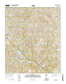
~ Snellville GA topo map, 1:24000 scale, 7.5 X 7.5 Minute, Current, 2014
Snellville, Georgia, USGS topographic map dated 2014.
Includes geographic coordinates (latitude and longitude). This topographic map is suitable for hiking, camping, and exploring, or framing it as a wall map.
Printed on-demand using high resolution imagery, on heavy weight and acid free paper, or alternatively on a variety of synthetic materials.
Topos available on paper, Waterproof, Poly, or Tyvek. Usually shipping rolled, unless combined with other folded maps in one order.
- Product Number: USGS-7536889
- Free digital map download (high-resolution, GeoPDF): Snellville, Georgia (file size: 38 MB)
- Map Size: please refer to the dimensions of the GeoPDF map above
- Weight (paper map): ca. 55 grams
- Map Type: POD USGS Topographic Map
- Map Series: US Topo
- Map Verison: Current
- Cell ID: 41877
- Datum: North American Datum of 1983
- Map Projection: Transverse Mercator
- Map Cell Name: Snellville
- Grid size: 7.5 X 7.5 Minute
- Date on map: 2014
- Map Scale: 1:24000
- Geographical region: Georgia, United States
Neighboring Maps:
All neighboring USGS topo maps are available for sale online at a variety of scales.
Spatial coverage:
Topo map Snellville, Georgia, covers the geographical area associated the following places:
- Camp Creek Estates - Sardum (historical) - Centerville - Norris Lake Shores - Meadow Hills - Cumberland Forest - Timber Trace - Shiloh Farms - Rockbridge - McGuires (historical) - Laurel Creek - Lenora - Quinn Ridge - Caleb - Rainbow Estates - Mountain Cove - Yellow River (historical) - Rock Chapel - The Moorings - Corinth Hills - Williams Place - Stonemont - Hickory Hills - Monterey Acres - Twin Village - Gwinnstone - Rivermist - Lake Lucerne Estates - Innsbrook West - Mason Woods - Country Square - Arbor Ridge - Lochwolde - Cedar Creek - Castlewood Mobile Home Park - Bermuda - Brandington Forest - Snellville - Innsbrook - The Landings - Scenic Mountain - Swift Creek - Smoke Creek Mobile Home Park - Rock Bridge - Summer Place
- Map Area ID: AREA33.87533.75-84.125-84
- Northwest corner Lat/Long code: USGSNW33.875-84.125
- Northeast corner Lat/Long code: USGSNE33.875-84
- Southwest corner Lat/Long code: USGSSW33.75-84.125
- Southeast corner Lat/Long code: USGSSE33.75-84
- Northern map edge Latitude: 33.875
- Southern map edge Latitude: 33.75
- Western map edge Longitude: -84.125
- Eastern map edge Longitude: -84


