
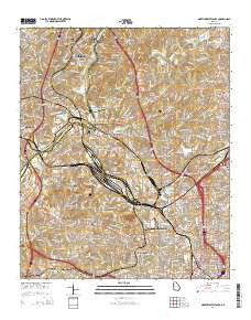
~ Northwest Atlanta GA topo map, 1:24000 scale, 7.5 X 7.5 Minute, Current, 2014
Northwest Atlanta, Georgia, USGS topographic map dated 2014.
Includes geographic coordinates (latitude and longitude). This topographic map is suitable for hiking, camping, and exploring, or framing it as a wall map.
Printed on-demand using high resolution imagery, on heavy weight and acid free paper, or alternatively on a variety of synthetic materials.
Topos available on paper, Waterproof, Poly, or Tyvek. Usually shipping rolled, unless combined with other folded maps in one order.
- Product Number: USGS-7536453
- Free digital map download (high-resolution, GeoPDF): Northwest Atlanta, Georgia (file size: 40 MB)
- Map Size: please refer to the dimensions of the GeoPDF map above
- Weight (paper map): ca. 55 grams
- Map Type: POD USGS Topographic Map
- Map Series: US Topo
- Map Verison: Current
- Cell ID: 32548
- Datum: North American Datum of 1983
- Map Projection: Transverse Mercator
- Map Cell Name: Northwest Atlanta
- Grid size: 7.5 X 7.5 Minute
- Date on map: 2014
- Map Scale: 1:24000
- Geographical region: Georgia, United States
Neighboring Maps:
All neighboring USGS topo maps are available for sale online at a variety of scales.
Spatial coverage:
Topo map Northwest Atlanta, Georgia, covers the geographical area associated the following places:
- Stratford - Brookwood - Slabtown (historical) - Battle Hill Haven - Miralia - Gilmore - Shermantown - Tilford - Vinings - Hills Park - Chattahoochee - Brookwood Hills - Vine City - Ansley Park - Ridgewood Heights - Payton (historical) - Magnolia - English Avenue Neighborhood - Rockdale - Bolton - Simsville - Westover Plantation - Woodward - Five Points - Northside Park - Grove Park - Ellen - Buckhead - Center Hill - Snake Nation (historical) - Carey Park - Riverside - Bellwood - Oakdale - Brooklyn - Forest Acres - Rivermeade
- Map Area ID: AREA33.87533.75-84.5-84.375
- Northwest corner Lat/Long code: USGSNW33.875-84.5
- Northeast corner Lat/Long code: USGSNE33.875-84.375
- Southwest corner Lat/Long code: USGSSW33.75-84.5
- Southeast corner Lat/Long code: USGSSE33.75-84.375
- Northern map edge Latitude: 33.875
- Southern map edge Latitude: 33.75
- Western map edge Longitude: -84.5
- Eastern map edge Longitude: -84.375


