
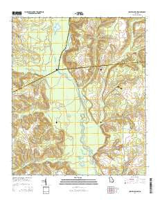
~ Cow Hell Swamp GA topo map, 1:24000 scale, 7.5 X 7.5 Minute, Current, 2014
Cow Hell Swamp, Georgia, USGS topographic map dated 2014.
Includes geographic coordinates (latitude and longitude). This topographic map is suitable for hiking, camping, and exploring, or framing it as a wall map.
Printed on-demand using high resolution imagery, on heavy weight and acid free paper, or alternatively on a variety of synthetic materials.
Topos available on paper, Waterproof, Poly, or Tyvek. Usually shipping rolled, unless combined with other folded maps in one order.
- Product Number: USGS-7535287
- Free digital map download (high-resolution, GeoPDF): Cow Hell Swamp, Georgia (file size: 34 MB)
- Map Size: please refer to the dimensions of the GeoPDF map above
- Weight (paper map): ca. 55 grams
- Map Type: POD USGS Topographic Map
- Map Series: US Topo
- Map Verison: Current
- Cell ID: 10428
- Datum: North American Datum of 1983
- Map Projection: Transverse Mercator
- Map Cell Name: Cow Hell Swamp
- Grid size: 7.5 X 7.5 Minute
- Date on map: 2014
- Map Scale: 1:24000
- Geographical region: Georgia, United States
Neighboring Maps:
All neighboring USGS topo maps are available for sale online at a variety of scales.
Spatial coverage:
Topo map Cow Hell Swamp, Georgia, covers the geographical area associated the following places:
- Deep Creek - Sarchett Lake - Tuckers Flat - Beaverdam Swamp - Holly Grove Cemetery - Dry Creek - Bowens Lake - Deep Creek Landing - Buckeye Creek - Gin Branch - Londonfield Cemetery - Halls Landing - Gin Branch - Jack Lake - Big Sandy Creek - Plummer Cemetery - Wynn Lake - Deep Creek - Old Evergreen School (historical) - Hall Landing - Evergreen Church - Guyton Cemetery - Stanley Cemetery - Yorks Dead River - Herberts Chapel - Messers Bridge - Fords Creek - Flat Creek - Kellams Cemetery - Cow Hell Swamp - Post Cemetery - Salem Cemetery - Chinaberry Ranch Airport - Goat Pond - Goose Creek - Walker Cemetery - Cullen Grove Church - Cullens Store (historical) - Little Sandy Creek - Clear Lake - Hightower Cemetery - Tobe Lake - Kellams Creek - Holly Springs Church - Moody Cemetery - Salem Church
- Map Area ID: AREA32.7532.625-83-82.875
- Northwest corner Lat/Long code: USGSNW32.75-83
- Northeast corner Lat/Long code: USGSNE32.75-82.875
- Southwest corner Lat/Long code: USGSSW32.625-83
- Southeast corner Lat/Long code: USGSSE32.625-82.875
- Northern map edge Latitude: 32.75
- Southern map edge Latitude: 32.625
- Western map edge Longitude: -83
- Eastern map edge Longitude: -82.875


