
~ Edmonds East WA topo map, 1:24000 scale, 7.5 X 7.5 Minute, Current, 2014
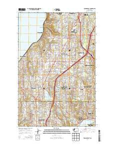
Edmonds East, Washington, USGS topographic map dated 2014.
Includes geographic coordinates (latitude and longitude). This topographic map is suitable for hiking, camping, and exploring, or framing it as a wall map.
Printed on-demand using high resolution imagery, on heavy weight and acid free paper, or alternatively on a variety of synthetic materials.
Topos available on paper, Waterproof, Poly, or Tyvek. Usually shipping rolled, unless combined with other folded maps in one order.
- Product Number: USGS-7529737
- Free digital map download (high-resolution, GeoPDF): Edmonds East, Washington (file size: 31 MB)
- Map Size: please refer to the dimensions of the GeoPDF map above
- Weight (paper map): ca. 55 grams
- Map Type: POD USGS Topographic Map
- Map Series: US Topo
- Map Verison: Current
- Cell ID: 13703
- Datum: North American Datum of 1983
- Map Projection: Transverse Mercator
- Map Cell Name: Edmonds East
- Grid size: 7.5 X 7.5 Minute
- Date on map: 2014
- Map Scale: 1:24000
- Geographical region: Washington, United States
Neighboring Maps:
All neighboring USGS topo maps are available for sale online at a variety of scales.
Spatial coverage:
Topo map Edmonds East, Washington, covers the geographical area associated the following places:
- King's Mobile Home Court - J and L Mobile Home Park - Manor Heights Mobile Home Park - Westburg Mobile Park - Mountain View Villa Mobile Home Park - Beardens Mobile Home Park - Meadowdale Mobile Home Park - Candlewood Estates Mobile Home Park - Squire Mobile Home Park - Country Club Senior Mobile Park - North Lynnwood - Medo Lynn Mobile Home Park - Courtyard Mobile Home Park - Lynnwood Heights Mobile Home Park - Spacette Mobile Home Community - Richmond Highlands - Beverly Acres - Tally Ho Mobile Home Park - Shady Glen Mobile Home Park - Evergreen Estates Mobile Homes - Cedar Valley - Alderwood Manor - Ridge Acres Mobile Home Park - Firdale - Echo Lake - Trailer Lane Mobile Park - Serene Terrace Mobile Home Park - Youngs Mobile Home Park - Center Mobile Park - Royalwood Mobile Home Estates - Meadowdale - Serene - Seattle Heights Mobile Home Park - Seattle Heights - Brier - Lynnwood Mobile Park - North City - Lake Forest Park - Lynnwood - Kingsbury West Mobile Home Park - Marks Mobile Home Park - Shoreline - Perrinville - Mountlake Terrace - Esperance - Kingsbury East Mobile Home Park
- Map Area ID: AREA47.87547.75-122.375-122.25
- Northwest corner Lat/Long code: USGSNW47.875-122.375
- Northeast corner Lat/Long code: USGSNE47.875-122.25
- Southwest corner Lat/Long code: USGSSW47.75-122.375
- Southeast corner Lat/Long code: USGSSE47.75-122.25
- Northern map edge Latitude: 47.875
- Southern map edge Latitude: 47.75
- Western map edge Longitude: -122.375
- Eastern map edge Longitude: -122.25


