
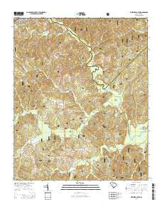
~ Whitmire South SC topo map, 1:24000 scale, 7.5 X 7.5 Minute, Current, 2014
Whitmire South, South Carolina, USGS topographic map dated 2014.
Includes geographic coordinates (latitude and longitude). This topographic map is suitable for hiking, camping, and exploring, or framing it as a wall map.
Printed on-demand using high resolution imagery, on heavy weight and acid free paper, or alternatively on a variety of synthetic materials.
Topos available on paper, Waterproof, Poly, or Tyvek. Usually shipping rolled, unless combined with other folded maps in one order.
- Product Number: USGS-7478076
- Free digital map download (high-resolution, GeoPDF): Whitmire South, South Carolina (file size: 43 MB)
- Map Size: please refer to the dimensions of the GeoPDF map above
- Weight (paper map): ca. 55 grams
- Map Type: POD USGS Topographic Map
- Map Series: US Topo
- Map Verison: Current
- Cell ID: 48903
- Datum: North American Datum of 1983
- Map Projection: Transverse Mercator
- Map Cell Name: Whitmire South
- Grid size: 7.5 X 7.5 Minute
- Date on map: 2014
- Map Scale: 1:24000
- Geographical region: South Carolina, United States
Neighboring Maps:
All neighboring USGS topo maps are available for sale online at a variety of scales.
Spatial coverage:
Topo map Whitmire South, South Carolina, covers the geographical area associated the following places:
- McCollough Church - First Church of God - Pattersons Creek - Brazzlemans Bridge - South Fork Kings Creek - Gilders Creek - Colonel Brown School (historical) - Indian Creek Rifle Range - Wilsons Creek - Kings Creek Cemetery - Kings Creek Church - Fosters Branch - New Hope Church - Long Lane - Laway School (historical) - Hunting Creek - Long Lane Branch School (historical) - Douglas School (historical) - Little Kings Creek - Mollyhorn School (historical) - Duncan Creek - Horseshoe Bend - Civilian Conservation Corps Camp F-6 (historical) - Collins Creek Hunt Camp - Saint Pauls Church (historical) - Sulphur Spring Branch - Renwick Grove Church - Whitmire Division - Enoree Ranger District Office - Indian Creek Work Center - Kings Creek - Bakers Cross Roads - Long Lane Hunt Camp - Mollys Rock Recreation Area - Asias Branch - Kings Creek School (historical) - Means Branch - Willow Oak Hunt Camp - Indian Creek - Long Lane School (historical) - Collins Branch - Long Lane Lookout Tower - Pentecostal Holiness Church - Avery Ford - McCullough School (historical) - New Hope Cemetery
- Map Area ID: AREA34.534.375-81.625-81.5
- Northwest corner Lat/Long code: USGSNW34.5-81.625
- Northeast corner Lat/Long code: USGSNE34.5-81.5
- Southwest corner Lat/Long code: USGSSW34.375-81.625
- Southeast corner Lat/Long code: USGSSE34.375-81.5
- Northern map edge Latitude: 34.5
- Southern map edge Latitude: 34.375
- Western map edge Longitude: -81.625
- Eastern map edge Longitude: -81.5


