
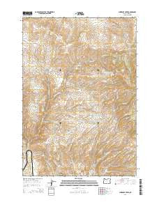
~ Lawrence Creek OR topo map, 1:24000 scale, 7.5 X 7.5 Minute, Current, 2014
Lawrence Creek, Oregon, USGS topographic map dated 2014.
Includes geographic coordinates (latitude and longitude). This topographic map is suitable for hiking, camping, and exploring, or framing it as a wall map.
Printed on-demand using high resolution imagery, on heavy weight and acid free paper, or alternatively on a variety of synthetic materials.
Topos available on paper, Waterproof, Poly, or Tyvek. Usually shipping rolled, unless combined with other folded maps in one order.
- Product Number: USGS-7261012
- Free digital map download (high-resolution, GeoPDF): Lawrence Creek, Oregon (file size: 29 MB)
- Map Size: please refer to the dimensions of the GeoPDF map above
- Weight (paper map): ca. 55 grams
- Map Type: POD USGS Topographic Map
- Map Series: US Topo
- Map Verison: Current
- Cell ID: 25146
- Datum: North American Datum of 1983
- Map Projection: Transverse Mercator
- Map Cell Name: Lawrence Creek
- Grid size: 7.5 X 7.5 Minute
- Date on map: 2014
- Map Scale: 1:24000
- Geographical region: Oregon, United States
Neighboring Maps:
All neighboring USGS topo maps are available for sale online at a variety of scales.
Spatial coverage:
Topo map Lawrence Creek, Oregon, covers the geographical area associated the following places:
- Iron Mountain Spring - Devils Spring - Black Springs Creek - Cattrill Creek - Cullom Post Office (historical) - Heater Creek - Orman Spring - Schlinkman Creek - Bedspring Flat Spring (historical) - Judd Creek - Lawrence Creek - Leonard (historical) - Taylor Reservoir - Sardine Creek - Olsen Gulch - South Guzzler Waterhole - South Fork Lawrence Creek - Hickerson Gulch - Taylor Ditch - Black Springs - Bedsprings Flat Reservoir - Welch Reservoir - Lyle Creek - Ayers Creek - Schuck Waterhole - Hayward Spring - Iron Mountain
- Map Area ID: AREA44.7544.625-117.5-117.375
- Northwest corner Lat/Long code: USGSNW44.75-117.5
- Northeast corner Lat/Long code: USGSNE44.75-117.375
- Southwest corner Lat/Long code: USGSSW44.625-117.5
- Southeast corner Lat/Long code: USGSSE44.625-117.375
- Northern map edge Latitude: 44.75
- Southern map edge Latitude: 44.625
- Western map edge Longitude: -117.5
- Eastern map edge Longitude: -117.375


