
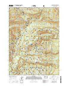
~ Hamaker Butte OR topo map, 1:24000 scale, 7.5 X 7.5 Minute, Current, 2014
Hamaker Butte, Oregon, USGS topographic map dated 2014.
Includes geographic coordinates (latitude and longitude). This topographic map is suitable for hiking, camping, and exploring, or framing it as a wall map.
Printed on-demand using high resolution imagery, on heavy weight and acid free paper, or alternatively on a variety of synthetic materials.
Topos available on paper, Waterproof, Poly, or Tyvek. Usually shipping rolled, unless combined with other folded maps in one order.
- Product Number: USGS-7259854
- Free digital map download (high-resolution, GeoPDF): Hamaker Butte, Oregon (file size: 43 MB)
- Map Size: please refer to the dimensions of the GeoPDF map above
- Weight (paper map): ca. 55 grams
- Map Type: POD USGS Topographic Map
- Map Series: US Topo
- Map Verison: Current
- Cell ID: 19034
- Datum: North American Datum of 1983
- Map Projection: Transverse Mercator
- Map Cell Name: Hamaker Butte
- Grid size: 7.5 X 7.5 Minute
- Date on map: 2014
- Map Scale: 1:24000
- Geographical region: Oregon, United States
Neighboring Maps:
All neighboring USGS topo maps are available for sale online at a variety of scales.
Spatial coverage:
Topo map Hamaker Butte, Oregon, covers the geographical area associated the following places:
- Beaver Meadows - South Fork National Creek - Park Meadows - Alkali Creek - Sherwood Creek - Bobs Bay - Minnehaha Camp - Hamaker Creek - Crescent Ridge - Hamaker Bluff - Buck Rock - West Fork Muir Creek - Prineville Camp (historical) - Three Lakes Trail - Lonesome Creek - Minnehaha Ridge - Lost Creek - Rim Rock Trail - Rim Rock - Hurryon Creek - Soda Spring - National Creek - Falls Creek - Muir Creek - Minnehaha Creek - Muir Creek Falls - Mazama Creek - Muir Camp - Sherwood Meadow - Minnehaha-Hurryon Trail - Log Camp - Hamaker Meadows - Rock Creek - Middle Fork National Creek - East Fork Muir Creek - Buck Camp - Haymaker Campground - National Creek Camp - Beaver Meadows Trail - Hamaker Recreation Site - Hurryon Camp - Forked Horn Creek - Rock Meadow - Buck Canyon - Hamaker Butte - Cascade Creek - Razor Ridge - Meadow Creek - Ice Creek - Beartree Creek - Lonesome Meadow - Clear Creek Camp - Sherwood Butte
- Map Area ID: AREA43.12543-122.375-122.25
- Northwest corner Lat/Long code: USGSNW43.125-122.375
- Northeast corner Lat/Long code: USGSNE43.125-122.25
- Southwest corner Lat/Long code: USGSSW43-122.375
- Southeast corner Lat/Long code: USGSSE43-122.25
- Northern map edge Latitude: 43.125
- Southern map edge Latitude: 43
- Western map edge Longitude: -122.375
- Eastern map edge Longitude: -122.25


