
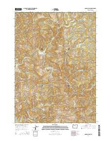
~ Golden Falls OR topo map, 1:24000 scale, 7.5 X 7.5 Minute, Current, 2014
Golden Falls, Oregon, USGS topographic map dated 2014.
Includes geographic coordinates (latitude and longitude). This topographic map is suitable for hiking, camping, and exploring, or framing it as a wall map.
Printed on-demand using high resolution imagery, on heavy weight and acid free paper, or alternatively on a variety of synthetic materials.
Topos available on paper, Waterproof, Poly, or Tyvek. Usually shipping rolled, unless combined with other folded maps in one order.
- Product Number: USGS-7259766
- Free digital map download (high-resolution, GeoPDF): Golden Falls, Oregon (file size: 39 MB)
- Map Size: please refer to the dimensions of the GeoPDF map above
- Weight (paper map): ca. 55 grams
- Map Type: POD USGS Topographic Map
- Map Series: US Topo
- Map Verison: Current
- Cell ID: 17623
- Datum: North American Datum of 1983
- Map Projection: Transverse Mercator
- Map Cell Name: Golden Falls
- Grid size: 7.5 X 7.5 Minute
- Date on map: 2014
- Map Scale: 1:24000
- Geographical region: Oregon, United States
Neighboring Maps:
All neighboring USGS topo maps are available for sale online at a variety of scales.
Spatial coverage:
Topo map Golden Falls, Oregon, covers the geographical area associated the following places:
- Coos River Fish Hatchery - Hewett Falls - Conklin Creek - Taylor Butte - Big Creek - Silver Falls - Golden Falls - East Creek - Eastside Division - Silver Creek - Millicoma Myrtle Grove State Park - Hodges Creek - Millicoma River Rearing Pond - Glenn Creek - Matson Creek - Golden and Silver Falls State Park - Little Matson Creek - Schoolhouse Creek - West Creek - Frog Creek - Millicoma River Rearing Pond Dam - West Fork Silver Creek - McKnight Creek - Fox Creek - Vaughn Point - Nesika County Park - Salmon Creek - Darius Creek - Rodine Creek - South Fork Matson Creek
- Map Area ID: AREA43.543.375-124-123.875
- Northwest corner Lat/Long code: USGSNW43.5-124
- Northeast corner Lat/Long code: USGSNE43.5-123.875
- Southwest corner Lat/Long code: USGSSW43.375-124
- Southeast corner Lat/Long code: USGSSE43.375-123.875
- Northern map edge Latitude: 43.5
- Southern map edge Latitude: 43.375
- Western map edge Longitude: -124
- Eastern map edge Longitude: -123.875


