
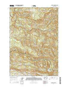
~ Gawley Creek OR topo map, 1:24000 scale, 7.5 X 7.5 Minute, Current, 2014
Gawley Creek, Oregon, USGS topographic map dated 2014.
Includes geographic coordinates (latitude and longitude). This topographic map is suitable for hiking, camping, and exploring, or framing it as a wall map.
Printed on-demand using high resolution imagery, on heavy weight and acid free paper, or alternatively on a variety of synthetic materials.
Topos available on paper, Waterproof, Poly, or Tyvek. Usually shipping rolled, unless combined with other folded maps in one order.
- Product Number: USGS-7259726
- Free digital map download (high-resolution, GeoPDF): Gawley Creek, Oregon (file size: 37 MB)
- Map Size: please refer to the dimensions of the GeoPDF map above
- Weight (paper map): ca. 55 grams
- Map Type: POD USGS Topographic Map
- Map Series: US Topo
- Map Verison: Current
- Cell ID: 16987
- Datum: North American Datum of 1983
- Map Projection: Transverse Mercator
- Map Cell Name: Gawley Creek
- Grid size: 7.5 X 7.5 Minute
- Date on map: 2014
- Map Scale: 1:24000
- Geographical region: Oregon, United States
Neighboring Maps:
All neighboring USGS topo maps are available for sale online at a variety of scales.
Spatial coverage:
Topo map Gawley Creek, Oregon, covers the geographical area associated the following places:
- Hell Cat Rock - Rhody Lake - Bee Ranch - Sucker Creek - Fibre Creek - Cow Creek - Dandelion Creek - Bull Creek - Pelkey Lake - South Gawley Ridge - Dog Rock - Fibre Lake - Mud Springs - Sweet Spring Creek - Gawley Meadow - Inventory Creek - South Fork Butte Creek - North Gawley Ridge - Murphy Camp - Horse Creek - Slide Creek - Picture Point - Lookout Mountain Lookout - Copper Lake - Trestle Creek - Gawley Creek - Pine Crest Trail - Boar Camp - Fibre Rock - Panther Rock - Copperhead Creek - Corbia Lake - Avalanche Creek - Shoofly Creek - Butte Lake - Bear Creek - Fill Creek - Gawley Basin
- Map Area ID: AREA4544.875-122.5-122.375
- Northwest corner Lat/Long code: USGSNW45-122.5
- Northeast corner Lat/Long code: USGSNE45-122.375
- Southwest corner Lat/Long code: USGSSW44.875-122.5
- Southeast corner Lat/Long code: USGSSE44.875-122.375
- Northern map edge Latitude: 45
- Southern map edge Latitude: 44.875
- Western map edge Longitude: -122.5
- Eastern map edge Longitude: -122.375


