
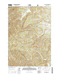
~ Flat Mountain OR topo map, 1:24000 scale, 7.5 X 7.5 Minute, Current, 2014
Flat Mountain, Oregon, USGS topographic map dated 2014.
Includes geographic coordinates (latitude and longitude). This topographic map is suitable for hiking, camping, and exploring, or framing it as a wall map.
Printed on-demand using high resolution imagery, on heavy weight and acid free paper, or alternatively on a variety of synthetic materials.
Topos available on paper, Waterproof, Poly, or Tyvek. Usually shipping rolled, unless combined with other folded maps in one order.
- Product Number: USGS-7259642
- Free digital map download (high-resolution, GeoPDF): Flat Mountain, Oregon (file size: 36 MB)
- Map Size: please refer to the dimensions of the GeoPDF map above
- Weight (paper map): ca. 55 grams
- Map Type: POD USGS Topographic Map
- Map Series: US Topo
- Map Verison: Current
- Cell ID: 15486
- Datum: North American Datum of 1983
- Map Projection: Transverse Mercator
- Map Cell Name: Flat Mountain
- Grid size: 7.5 X 7.5 Minute
- Date on map: 2014
- Map Scale: 1:24000
- Geographical region: Oregon, United States
Neighboring Maps:
All neighboring USGS topo maps are available for sale online at a variety of scales.
Spatial coverage:
Topo map Flat Mountain, Oregon, covers the geographical area associated the following places:
- Wells Creek - Gleason Creek - Decker Ridge - Mercer Creek - Benton County - Bunker Hill - Hyde Creek - Westwood Creek - Powell Cemetery - Flat Mountain - Cheyenne Creek - South Creek - Franklin Ridge - Emerich Cemetery - Schreiber Lodge Boy Scout Camp - Moss Creek - Cedar Creek - Beaver Creek Seed Orchard - Dinner Creek - Hells Canyon - Henderson Creek - Buck Peak - Duffy Creek - Kiser Creek - Ridenour Creek - Ervin Creek - Powell Creek - Rickard Creek - Spencer Creek
- Map Area ID: AREA44.544.375-123.5-123.375
- Northwest corner Lat/Long code: USGSNW44.5-123.5
- Northeast corner Lat/Long code: USGSNE44.5-123.375
- Southwest corner Lat/Long code: USGSSW44.375-123.5
- Southeast corner Lat/Long code: USGSSE44.375-123.375
- Northern map edge Latitude: 44.5
- Southern map edge Latitude: 44.375
- Western map edge Longitude: -123.5
- Eastern map edge Longitude: -123.375


