
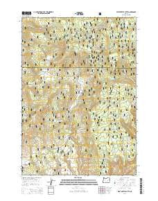
~ West Myrtle Butte OR topo map, 1:24000 scale, 7.5 X 7.5 Minute, Current, 2014
West Myrtle Butte, Oregon, USGS topographic map dated 2014.
Includes geographic coordinates (latitude and longitude). This topographic map is suitable for hiking, camping, and exploring, or framing it as a wall map.
Printed on-demand using high resolution imagery, on heavy weight and acid free paper, or alternatively on a variety of synthetic materials.
Topos available on paper, Waterproof, Poly, or Tyvek. Usually shipping rolled, unless combined with other folded maps in one order.
- Product Number: USGS-7255210
- Free digital map download (high-resolution, GeoPDF): West Myrtle Butte, Oregon (file size: 41 MB)
- Map Size: please refer to the dimensions of the GeoPDF map above
- Weight (paper map): ca. 55 grams
- Map Type: POD USGS Topographic Map
- Map Series: US Topo
- Map Verison: Current
- Cell ID: 48229
- Datum: North American Datum of 1983
- Map Projection: Transverse Mercator
- Map Cell Name: West Myrtle Butte
- Grid size: 7.5 X 7.5 Minute
- Date on map: 2014
- Map Scale: 1:24000
- Geographical region: Oregon, United States
Neighboring Maps:
All neighboring USGS topo maps are available for sale online at a variety of scales.
Spatial coverage:
Topo map West Myrtle Butte, Oregon, covers the geographical area associated the following places:
- Rainbow Spring - Sugarloaf Mountain - Alder Creek - Soup Spring - Link Bar Spring - Sugarloaf Spring - Sallys Flat - Dry Creek Spring - Sugarloaf Mountain Fire Lookout - Gribble Spring - Tipton Spring - Rainbow Creek - Robinson Spring - Izee Spring - Deer Spring - Bingham Spring - WogonagaT potso-na Flat Spring - Sage Hen Spring - West Myrtle Butte Forest Service Facility - J T Spring - Summit Spring - West Myrtle Butte Fire Lookout - Sallys Flat Spring - Black Snag Spring - Brad Spring - Mud Spring - West Myrtle Butte - Badger Flat - Hole-in-the-Ground Spring - Thornburg Spring - Twin Springs - WogonagaT potso-na Flat - West Myrtle Spring - Cooley Creek - Cold Spring
- Map Area ID: AREA4443.875-119.25-119.125
- Northwest corner Lat/Long code: USGSNW44-119.25
- Northeast corner Lat/Long code: USGSNE44-119.125
- Southwest corner Lat/Long code: USGSSW43.875-119.25
- Southeast corner Lat/Long code: USGSSE43.875-119.125
- Northern map edge Latitude: 44
- Southern map edge Latitude: 43.875
- Western map edge Longitude: -119.25
- Eastern map edge Longitude: -119.125


