
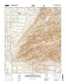
~ Tanque Verde Peak AZ topo map, 1:24000 scale, 7.5 X 7.5 Minute, 2014
Tanque Verde Peak, Arizona, USGS topographic map dated 2014.
Includes geographic coordinates (latitude and longitude). This topographic map is suitable for hiking, camping, and exploring, or framing it as a wall map.
Printed on-demand using high resolution imagery, on heavy weight and acid free paper, or alternatively on a variety of synthetic materials.
Topos available on paper, Waterproof, Poly, or Tyvek. Usually shipping rolled, unless combined with other folded maps in one order.
- Product Number: USGS-7241975
- Free digital map download (high-resolution, GeoPDF): Tanque Verde Peak, Arizona (file size: 31 MB)
- Map Size: please refer to the dimensions of the GeoPDF map above
- Weight (paper map): ca. 55 grams
- Map Type: POD USGS Topographic Map
- Map Series: US Topo
- Map Verison: Current
- Cell ID: 44293
- Datum: North American Datum of 1983
- Map Projection: Transverse Mercator
- Map Cell Name: Tanque Verde Peak
- Grid size: 7.5 X 7.5 Minute
- Date on map: 2014
- Map Scale: 1:24000
- Geographical region: Arizona, United States
Neighboring Maps:
All neighboring USGS topo maps are available for sale online at a variety of scales.
Spatial coverage:
Topo map Tanque Verde Peak, Arizona, covers the geographical area associated the following places:
- La Mesa del Oso Tank - Thunderbird Ranch - La Cebadilla Lake - Deer Camp - Cement Cabin - First Tank - Canyon del Salto - Aguila Tank - Portoritas Tank - Tanque Verde Cemetery - Saguaro Buttes Community Church - Hope Camp - Forty-Nine Country Club - Mica Tank - KRKR-AM (Tucson Estates) - Tanque Verde Ridge Trail - Tanque Verde Canyon - Rincon Creek - Wild Horse Canyon - Aguila Corral - Scotts Knob - Box Canyon - Sentinel Butte - Tanque Verde Ranch - Tanque Verde Ranch Cemetery - Tina Larga Tank - Juniper Basin - Steel Tank - Fresno Spring - Forty Niner Golf and Country Club - Tanque Verde Peak - Thunderhead Airport (historical) - Gambusi Lake - Old Spanish Trail Church - Mesa de la Osa - Wild Horse Corral - Saguaro Wilderness - Rock Spring
- Map Area ID: AREA32.2532.125-110.75-110.625
- Northwest corner Lat/Long code: USGSNW32.25-110.75
- Northeast corner Lat/Long code: USGSNE32.25-110.625
- Southwest corner Lat/Long code: USGSSW32.125-110.75
- Southeast corner Lat/Long code: USGSSE32.125-110.625
- Northern map edge Latitude: 32.25
- Southern map edge Latitude: 32.125
- Western map edge Longitude: -110.75
- Eastern map edge Longitude: -110.625


