
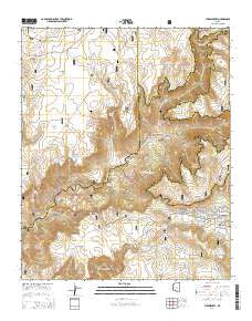
~ Strawberry AZ topo map, 1:24000 scale, 7.5 X 7.5 Minute, 2014
Strawberry, Arizona, USGS topographic map dated 2014.
Includes geographic coordinates (latitude and longitude). This topographic map is suitable for hiking, camping, and exploring, or framing it as a wall map.
Printed on-demand using high resolution imagery, on heavy weight and acid free paper, or alternatively on a variety of synthetic materials.
Topos available on paper, Waterproof, Poly, or Tyvek. Usually shipping rolled, unless combined with other folded maps in one order.
- Product Number: USGS-7241901
- Free digital map download (high-resolution, GeoPDF): Strawberry, Arizona (file size: 28 MB)
- Map Size: please refer to the dimensions of the GeoPDF map above
- Weight (paper map): ca. 55 grams
- Map Type: POD USGS Topographic Map
- Map Series: US Topo
- Map Verison: Current
- Cell ID: 43457
- Datum: North American Datum of 1983
- Map Projection: Transverse Mercator
- Map Cell Name: Strawberry
- Grid size: 7.5 X 7.5 Minute
- Date on map: 2014
- Map Scale: 1:24000
- Geographical region: Arizona, United States
Neighboring Maps:
All neighboring USGS topo maps are available for sale online at a variety of scales.
Spatial coverage:
Topo map Strawberry, Arizona, covers the geographical area associated the following places:
- Mud Tank - Mud Seep - Blackies Tank - Lazy T-seven Ranch - Pocket Point Tank - Mail Trail Tank Number Two - Mud Number One Tank - Gnat Tank - Herbies Tank - Nash Point - Maple Spring Tank - Rafter Tank - Horsetank Wash - Petes Tank - Slaughter Tank - Natural Tank - Freckles Tank - Gus Tank - Peak Tank - Strawberry Census Designated Place - Deadman Mesa - Strawberry Chapel in the Pines - Pine Tank - F U Tank - The Cove - Strawberry Creek - Shake Pile Tank - Charleys Tank - Strawberry Valley - Oak Tank - Slate Tank - Hopeful Tank - Sandrock Canyon - Tin Can Tank - Antelope Tank - Divide Tank - Mesa Tank - Stan Tank - Calf Pen Canyon - Natural Spring - Fossil Springs Wilderness - Irving Powerplant - Blue Tank - Y H Tank - Pine - Strawberry Fire District Station 42 - The Pocket - Nash Pasture Tank - Tin Can Draw - Mogollon Mesa - Road Tank - KRIM-FM (Payson) - KRMM-FM (Payson) - Hopeful Tank - Fossil Springs - Mud Tanks Draw
- Map Area ID: AREA34.534.375-111.625-111.5
- Northwest corner Lat/Long code: USGSNW34.5-111.625
- Northeast corner Lat/Long code: USGSNE34.5-111.5
- Southwest corner Lat/Long code: USGSSW34.375-111.625
- Southeast corner Lat/Long code: USGSSE34.375-111.5
- Northern map edge Latitude: 34.5
- Southern map edge Latitude: 34.375
- Western map edge Longitude: -111.625
- Eastern map edge Longitude: -111.5


