
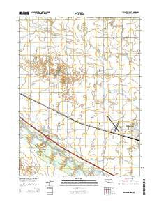
~ Lexington West NE topo map, 1:24000 scale, 7.5 X 7.5 Minute, 2014
Lexington West, Nebraska, USGS topographic map dated 2014.
Includes geographic coordinates (latitude and longitude). This topographic map is suitable for hiking, camping, and exploring, or framing it as a wall map.
Printed on-demand using high resolution imagery, on heavy weight and acid free paper, or alternatively on a variety of synthetic materials.
Topos available on paper, Waterproof, Poly, or Tyvek. Usually shipping rolled, unless combined with other folded maps in one order.
- Product Number: USGS-7161799
- Free digital map download (high-resolution, GeoPDF): Lexington West, Nebraska (file size: 20 MB)
- Map Size: please refer to the dimensions of the GeoPDF map above
- Weight (paper map): ca. 55 grams
- Map Type: POD USGS Topographic Map
- Map Series: US Topo
- Map Verison: Current
- Cell ID: 25604
- Datum: North American Datum of 1983
- Map Projection: Transverse Mercator
- Map Cell Name: Lexington West
- Grid size: 7.5 X 7.5 Minute
- Date on map: 2014
- Map Scale: 1:24000
- Geographical region: Nebraska, United States
Neighboring Maps:
All neighboring USGS topo maps are available for sale online at a variety of scales.
Spatial coverage:
Topo map Lexington West, Nebraska, covers the geographical area associated the following places:
- School Number 38 - Interchange 231 - The Church of Jesus Christ of Latter Day Saints - Jim Kelly Field - Plum Creek Park - Bitterns Call State Wildlife Management Area - Hewitt Cemetery - School Number 16 - Sandoz Elementary School - Dawson County - Darr Feedlot - School Number 22 - Assemblies of God Conference Grounds - Darr Bridge - Markel (historical) - Grace Cemetery - Lateral Number 1 - Lexington Election Precinct - Plum Creek Medical Group - Parkview Baptist Church - First Christian Church - Dawson County Drain Number 1 - Buffalo Grove Church - Tri - County Area Hospital District
- Map Area ID: AREA40.87540.75-99.875-99.75
- Northwest corner Lat/Long code: USGSNW40.875-99.875
- Northeast corner Lat/Long code: USGSNE40.875-99.75
- Southwest corner Lat/Long code: USGSSW40.75-99.875
- Southeast corner Lat/Long code: USGSSE40.75-99.75
- Northern map edge Latitude: 40.875
- Southern map edge Latitude: 40.75
- Western map edge Longitude: -99.875
- Eastern map edge Longitude: -99.75


