
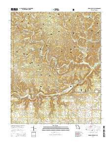
~ Piedmont Hollow MO topo map, 1:24000 scale, 7.5 X 7.5 Minute, 2015
Piedmont Hollow, Missouri, USGS topographic map dated 2015.
Includes geographic coordinates (latitude and longitude). This topographic map is suitable for hiking, camping, and exploring, or framing it as a wall map.
Printed on-demand using high resolution imagery, on heavy weight and acid free paper, or alternatively on a variety of synthetic materials.
Topos available on paper, Waterproof, Poly, or Tyvek. Usually shipping rolled, unless combined with other folded maps in one order.
- Product Number: USGS-7151409
- Free digital map download (high-resolution, GeoPDF): Piedmont Hollow, Missouri (file size: 26 MB)
- Map Size: please refer to the dimensions of the GeoPDF map above
- Weight (paper map): ca. 55 grams
- Map Type: POD USGS Topographic Map
- Map Series: US Topo
- Map Verison: Current
- Cell ID: 35059
- Datum: North American Datum of 1983
- Map Projection: Transverse Mercator
- Map Cell Name: Piedmont Hollow
- Grid size: 7.5 X 7.5 Minute
- Date on map: 2015
- Map Scale: 1:24000
- Geographical region: Missouri, United States
Neighboring Maps:
All neighboring USGS topo maps are available for sale online at a variety of scales.
Spatial coverage:
Topo map Piedmont Hollow, Missouri, covers the geographical area associated the following places:
- Thompson Spring - Doniphan Hollow - Jackson Hollow - Paty Pond - Denny Hollow - Tupelo Gum Pond - Mine Hollow - Bandyville Post Office - George Ridge - Camp House Spring - Hog Hollow - Cane Bluff Hollow - Camp Hollow - Posy Spring - Cumberland Church - Blowing Spring - Low Wassie Creek - Cane Bluff - Sheep Ranch Hollow - Bull Camp Hollow - Cane Bluff Access Ramp Canoe Dock - Blue Ridge Trail - Graham Hollow - Devils Backbone - Bockman Spring - Well Hollow - Buck Hollow - Johnson Hollow - Paty Hollow - Spring Creek School - Denny Hollow Float Camp - Cooper Spring - Paty Spring - Becky Hollow - Twin Springs - Bryan School (historical) - Dry Creek - Bee Fork Creek - Wolfpen Hollow - Township of Woodside - Blue Ridge Trail Trailhead - Granddaddy Ridge - Round Hollow - Eleven Point National Scenic River - Cave Spring Hollow - Union Ford - Threemile Hollow - Spring Creek - Piedmont Hollow - Macedonia Church - Macedonia School - Union Church (historical) - Roaring Spring - Spring Creek Cemetery - Pine Hill School (historical) - Orchard Hollow - Graham Spring - Bandyville - Church of Christ - Jenny Hollow - Hickory Grove Cemetery - Elm Pond - Blubbering Hollow - Betsy Hollow
- Map Area ID: AREA36.87536.75-91.5-91.375
- Northwest corner Lat/Long code: USGSNW36.875-91.5
- Northeast corner Lat/Long code: USGSNE36.875-91.375
- Southwest corner Lat/Long code: USGSSW36.75-91.5
- Southeast corner Lat/Long code: USGSSE36.75-91.375
- Northern map edge Latitude: 36.875
- Southern map edge Latitude: 36.75
- Western map edge Longitude: -91.5
- Eastern map edge Longitude: -91.375


