
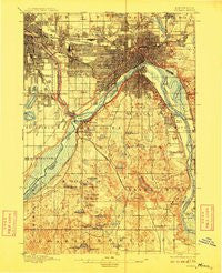
~ St Paul MN topo map, 1:62500 scale, 15 X 15 Minute, Historical, 1896, updated 1909
St Paul, Minnesota, USGS topographic map dated 1896.
Includes geographic coordinates (latitude and longitude). This topographic map is suitable for hiking, camping, and exploring, or framing it as a wall map.
Printed on-demand using high resolution imagery, on heavy weight and acid free paper, or alternatively on a variety of synthetic materials.
Topos available on paper, Waterproof, Poly, or Tyvek. Usually shipping rolled, unless combined with other folded maps in one order.
- Product Number: USGS-6006924
- Free digital map download (high-resolution, GeoPDF): St Paul, Minnesota (file size: 6 MB)
- Map Size: please refer to the dimensions of the GeoPDF map above
- Weight (paper map): ca. 55 grams
- Map Type: POD USGS Topographic Map
- Map Series: HTMC
- Map Verison: Historical
- Cell ID: 62007
- Scan ID: 805526
- Imprint Year: 1909
- Survey Year: 1894
- Datum: Unstated
- Map Projection: Unstated
- Map published by United States Geological Survey
- Map Language: English
- Scanner Resolution: 508 dpi
- Map Cell Name: Saint Paul
- Grid size: 15 X 15 Minute
- Date on map: 1896
- Map Scale: 1:62500
- Geographical region: Minnesota, United States
Neighboring Maps:
All neighboring USGS topo maps are available for sale online at a variety of scales.
Spatial coverage:
Topo map St Paul, Minnesota, covers the geographical area associated the following places:
- Lauderdale - Cedar Grove - Mendota Heights - Eagan - Pine Bend - West Saint Paul - Inver Grove Heights - Wescott - Highwood - Lilydale - Sunfish Lake - Roseport - Newport - Nicols - Saint Paul - Mendota - Gladstone - Falcon Heights - South Saint Paul
- Map Area ID: AREA4544.75-93.25-93
- Northwest corner Lat/Long code: USGSNW45-93.25
- Northeast corner Lat/Long code: USGSNE45-93
- Southwest corner Lat/Long code: USGSSW44.75-93.25
- Southeast corner Lat/Long code: USGSSE44.75-93
- Northern map edge Latitude: 45
- Southern map edge Latitude: 44.75
- Western map edge Longitude: -93.25
- Eastern map edge Longitude: -93


