
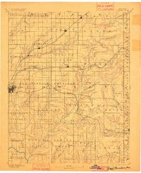
~ Burden KS topo map, 1:125000 scale, 30 X 30 Minute, Historical, 1889, updated 1901
Burden, Kansas, USGS topographic map dated 1889.
Includes geographic coordinates (latitude and longitude). This topographic map is suitable for hiking, camping, and exploring, or framing it as a wall map.
Printed on-demand using high resolution imagery, on heavy weight and acid free paper, or alternatively on a variety of synthetic materials.
Topos available on paper, Waterproof, Poly, or Tyvek. Usually shipping rolled, unless combined with other folded maps in one order.
- Product Number: USGS-5970088
- Free digital map download (high-resolution, GeoPDF): Burden, Kansas (file size: 4 MB)
- Map Size: please refer to the dimensions of the GeoPDF map above
- Weight (paper map): ca. 55 grams
- Map Type: POD USGS Topographic Map
- Map Series: HTMC
- Map Verison: Historical
- Cell ID: 65082
- Scan ID: 802070
- Imprint Year: 1901
- Survey Year: 1885
- Datum: Unstated
- Map Projection: Unstated
- Map published by United States Geological Survey
- Map Language: English
- Scanner Resolution: 508 dpi
- Map Cell Name: Burden
- Grid size: 30 X 30 Minute
- Date on map: 1889
- Map Scale: 1:125000
- Geographical region: Kansas, United States
Neighboring Maps:
All neighboring USGS topo maps are available for sale online at a variety of scales.
Spatial coverage:
Topo map Burden, Kansas, covers the geographical area associated the following places:
- Cedar Vale - Hooser - Vinton - Parkerfield - Silverdale - Eschs (historical) - Eaton - Wingate - Burden - Dexter - Grand Summit - Glenview Estates Mobile Home Park - Taussig - Glen Crouse - Wilmot - New Salem - Cameron - Cambridge - Winfield - Floral - Tisdale - Atlanta - Maple City - Pleasant Valley (historical) - Glen Grouse (historical) - Louanns Mobile Home Park
- Map Area ID: AREA37.537-97-96.5
- Northwest corner Lat/Long code: USGSNW37.5-97
- Northeast corner Lat/Long code: USGSNE37.5-96.5
- Southwest corner Lat/Long code: USGSSW37-97
- Southeast corner Lat/Long code: USGSSE37-96.5
- Northern map edge Latitude: 37.5
- Southern map edge Latitude: 37
- Western map edge Longitude: -97
- Eastern map edge Longitude: -96.5


