
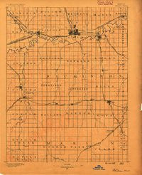
~ Abilene KS topo map, 1:125000 scale, 30 X 30 Minute, Historical, 1889
Abilene, Kansas, USGS topographic map dated 1889.
Includes geographic coordinates (latitude and longitude). This topographic map is suitable for hiking, camping, and exploring, or framing it as a wall map.
Printed on-demand using high resolution imagery, on heavy weight and acid free paper, or alternatively on a variety of synthetic materials.
Topos available on paper, Waterproof, Poly, or Tyvek. Usually shipping rolled, unless combined with other folded maps in one order.
- Product Number: USGS-5969580
- Free digital map download (high-resolution, GeoPDF): Abilene, Kansas (file size: 4 MB)
- Map Size: please refer to the dimensions of the GeoPDF map above
- Weight (paper map): ca. 55 grams
- Map Type: POD USGS Topographic Map
- Map Series: HTMC
- Map Verison: Historical
- Cell ID: 64844
- Scan ID: 802048
- Survey Year: 1888
- Datum: Unstated
- Map Projection: Unstated
- Map published by United States Geological Survey
- Map Language: English
- Scanner Resolution: 508 dpi
- Map Cell Name: Abilene
- Grid size: 30 X 30 Minute
- Date on map: 1889
- Map Scale: 1:125000
- Geographical region: Kansas, United States
Neighboring Maps:
All neighboring USGS topo maps are available for sale online at a variety of scales.
Spatial coverage:
Topo map Abilene, Kansas, covers the geographical area associated the following places:
- Detroit - Acme - Roxbury - M and M Mobile Home Court - Abilene - Shamrock Mobile Home Estates - Holland - Navarre - Niles - Elmo - Carlton - Ramona - Enterprise - Dillon - Sand Spring - Rishel - Red Rock Mobile Home Park - Tampa - Kipp - Solomon - Jacobs - Cottonwood Mobile Home Park - Chapman - Hope - John's Mobile Home Park - Gypsum - Pearl
- Map Area ID: AREA3938.5-97.5-97
- Northwest corner Lat/Long code: USGSNW39-97.5
- Northeast corner Lat/Long code: USGSNE39-97
- Southwest corner Lat/Long code: USGSSW38.5-97.5
- Southeast corner Lat/Long code: USGSSE38.5-97
- Northern map edge Latitude: 39
- Southern map edge Latitude: 38.5
- Western map edge Longitude: -97.5
- Eastern map edge Longitude: -97


