
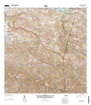
~ San Sebastian PR topo map, 1:20000 scale, 7.5 X 7.5 Minute, Historical, 2013
San Sebastian, Puerto Rico, USGS topographic map dated 2013.
Includes geographic coordinates (latitude and longitude). This topographic map is suitable for hiking, camping, and exploring, or framing it as a wall map.
Printed on-demand using high resolution imagery, on heavy weight and acid free paper, or alternatively on a variety of synthetic materials.
Topos available on paper, Waterproof, Poly, or Tyvek. Usually shipping rolled, unless combined with other folded maps in one order.
- Product Number: USGS-5964566
- Free digital map download (high-resolution, GeoPDF): San Sebastian, Puerto Rico (file size: 49 MB)
- Map Size: please refer to the dimensions of the GeoPDF map above
- Weight (paper map): ca. 55 grams
- Map Type: POD USGS Topographic Map
- Map Series: US Topo
- Map Verison: Historical
- Cell ID: 39708
- Datum: North American Datum of 1983
- Map Projection: Transverse Mercator
- Map Cell Name: San Sebastian
- Grid size: 7.5 X 7.5 Minute
- Date on map: 2013
- Map Scale: 1:20000
- Geographical region: Puerto Rico, United States
Neighboring Maps:
All neighboring USGS topo maps are available for sale online at a variety of scales.
Spatial coverage:
Topo map San Sebastian, Puerto Rico, covers the geographical area associated the following places:
- Jardines de Lares - San Sebastián Zona Urbana - Lares - Juncal - Barriada Chinto Rodon - Hacienda San Pedro - Sector Rafael Castro - Pedro Tomas La Valle - Emerito Estra da Rivera - Sector Retiro - Buena Vista - Las Marías Zona Urbana - Juncal Comunidad - Tabonuco - Acevedo - Jardines de Venturrini - El Culebrinas - Las Marías - San Sebastián - Lares Zona Urbana - El Salto - Sector Arizon - Campamento Guajataca - Muñoz Torruellas - Residencial Francisco Sein - Boulevardo Majadero - Perchas - Pacalelo 38 - El Guayabal - Hacienda Canabal (historical) - Reparto Roman - La González - Hacienda Porvenir
- Map Area ID: AREA18.37518.25-67-66.875
- Northwest corner Lat/Long code: USGSNW18.375-67
- Northeast corner Lat/Long code: USGSNE18.375-66.875
- Southwest corner Lat/Long code: USGSSW18.25-67
- Southeast corner Lat/Long code: USGSSE18.25-66.875
- Northern map edge Latitude: 18.375
- Southern map edge Latitude: 18.25
- Western map edge Longitude: -67
- Eastern map edge Longitude: -66.875


