
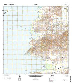
~ Puerto Real PR topo map, 1:20000 scale, 7.5 X 7.5 Minute, Historical, 2013
Puerto Real, Puerto Rico, USGS topographic map dated 2013.
Includes geographic coordinates (latitude and longitude). This topographic map is suitable for hiking, camping, and exploring, or framing it as a wall map.
Printed on-demand using high resolution imagery, on heavy weight and acid free paper, or alternatively on a variety of synthetic materials.
Topos available on paper, Waterproof, Poly, or Tyvek. Usually shipping rolled, unless combined with other folded maps in one order.
- Product Number: USGS-5964554
- Free digital map download (high-resolution, GeoPDF): Puerto Real, Puerto Rico (file size: 29 MB)
- Map Size: please refer to the dimensions of the GeoPDF map above
- Weight (paper map): ca. 55 grams
- Map Type: POD USGS Topographic Map
- Map Series: US Topo
- Map Verison: Historical
- Cell ID: 36601
- Datum: North American Datum of 1983
- Map Projection: Transverse Mercator
- Map Cell Name: Puerto Real
- Grid size: 7.5 X 7.5 Minute
- Date on map: 2013
- Map Scale: 1:20000
- Geographical region: Puerto Rico, United States
Neighboring Maps:
All neighboring USGS topo maps are available for sale online at a variety of scales.
Spatial coverage:
Topo map Puerto Real, Puerto Rico, covers the geographical area associated the following places:
- Pueblo Norte - Puerto Real - Parabueyón - Garita - Llanos Tuna - Isabel Josefa - Boquerón Comunidad - Hacienda La Ratina - Delicias - Cuatro Caminos - Las Arenas - Cabo Rojo Zona Urbana - Cuatro Calles - Cabo Rojo - Morales Díaz - Puerto Real Comunidad - Sosa - Los Flamboyanes - Sabana Alta - El Cerro - Guaniquilla - Pueblo Nuevo - Pueblo Sur - Boquerón - Belvedere - Betances - Ballajá - Betances Comunidad - Joyuda - Elizabeth - Conde Ávila
- Map Area ID: AREA18.12518-67.25-67.125
- Northwest corner Lat/Long code: USGSNW18.125-67.25
- Northeast corner Lat/Long code: USGSNE18.125-67.125
- Southwest corner Lat/Long code: USGSSW18-67.25
- Southeast corner Lat/Long code: USGSSE18-67.125
- Northern map edge Latitude: 18.125
- Southern map edge Latitude: 18
- Western map edge Longitude: -67.25
- Eastern map edge Longitude: -67.125


