
~ Yap Islands Waqab FM topo map, 1:25000 scale, 7.5 X 7.5 Minute, Historical, 1996, updated 2003
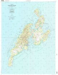
Yap Islands Waqab , Federated States of Micronesia, USGS topographic map dated 1996.
Includes geographic coordinates (latitude and longitude). This topographic map is suitable for hiking, camping, and exploring, or framing it as a wall map.
Printed on-demand using high resolution imagery, on heavy weight and acid free paper, or alternatively on a variety of synthetic materials.
Topos available on paper, Waterproof, Poly, or Tyvek. Usually shipping rolled, unless combined with other folded maps in one order.
- Product Number: USGS-5950422
- Free digital map download (high-resolution, GeoPDF): Yap Islands Waqab , Federated States of Micronesia (file size: 19 MB)
- Map Size: please refer to the dimensions of the GeoPDF map above
- Weight (paper map): ca. 55 grams
- Map Type: POD USGS Topographic Map
- Map Series: HTMC
- Map Verison: Historical
- Cell ID: 395608
- Scan ID: 363630
- Imprint Year: 2003
- Woodland Tint: Yes
- Aerial Photo Year: 1996
- Datum: NAD83
- Map Projection: Universal Transverse Mercator
- Map published by United States Geological Survey
- Map published by: Military, Other
- Keywords: Overedge with No Adjacent Map
- Map Language: English
- Scanner Resolution: 600 dpi
- Map Cell Name: Yap Islands (Waqab)
- Grid size: 7.5 X 7.5 Minute
- Date on map: 1996
- Map Scale: 1:25000
- Geographical region: Federated States of Micronesia, United States
Neighboring Maps:
All neighboring USGS topo maps are available for sale online at a variety of scales.
Spatial coverage:
Topo map Yap Islands Waqab , Federated States of Micronesia, covers the geographical area associated the following places:
- Guroor - Wachoelaeb - Maaq - Meay - Maqweach - Liil - Thuunbil'iy - Worwoq - Binaew - Deeningol - Bulwol - Micheew - Yabach - Kanif - Baqanimaqut - Maakiy - Gachpar - Weenfaraq - Faal - Mireeniiw - Toeruw - Maedriich - Palaaw - Machangad - Taqabaaw - Riikeen - Bechyal - Goqchol - Dachangar - N'eef - Muloeloew - T'eanfaar - Qoon - Mussiilog - Yimuch - Tabeelaeng - Talangith - Wugeem - Kadaay - Maseesin - Gitaem - Meer - Tabnifiy - Qamin - Qamun - Derraak - Qayirech - Rumuug - Numdul - Wareaf - Ruun'uw - Moongael - Gaqnipaan - Fiteadooq - Qokaaw - Gaqnaqun - Raeng - Colonia - Ngolog - Torliyog - Malaaf - Ngathaaw' - Gachalaaw - Feeduqor - Neel - Nimaar - Tagaam' - Darachaq - Makal - Tageegiin - Wanyaan - Loothog - Qeedugor - Fanqaliiliy - Bugol - Daabach - Maaq - Magaaf - Beenik - Meechoqol - Qanooth - Nluul - Dugor - Qichigiyoeg - Ngariy - Teab - Leang - Dilaeg - Mal'aay - Waaloo - Taalgum - Magachgil - Baleabaat' - Lamear - Ngolog - Madargil - Madalaay' - Ruuq - Gargey - Dariikaan
- Map Area ID: AREA9.66111119.4166667138.0333333138.2166667
- Northwest corner Lat/Long code: USGSNW9.6611111138.0333333
- Northeast corner Lat/Long code: USGSNE9.6611111138.2166667
- Southwest corner Lat/Long code: USGSSW9.4166667138.0333333
- Southeast corner Lat/Long code: USGSSE9.4166667138.2166667
- Northern map edge Latitude: 9.6611111
- Southern map edge Latitude: 9.4166667
- Western map edge Longitude: 138.0333333
- Eastern map edge Longitude: 138.2166667


