
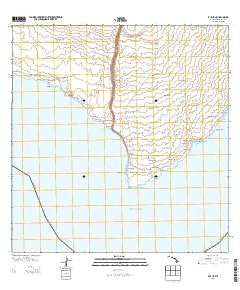
~ Kalae HI topo map, 1:24000 scale, 7.5 X 7.5 Minute, Historical, 2013
Kalae, Hawaii, USGS topographic map dated 2013.
Includes geographic coordinates (latitude and longitude). This topographic map is suitable for hiking, camping, and exploring, or framing it as a wall map.
Printed on-demand using high resolution imagery, on heavy weight and acid free paper, or alternatively on a variety of synthetic materials.
Topos available on paper, Waterproof, Poly, or Tyvek. Usually shipping rolled, unless combined with other folded maps in one order.
- Product Number: USGS-5949316
- Free digital map download (high-resolution, GeoPDF): Kalae, Hawaii (file size: 21 MB)
- Map Size: please refer to the dimensions of the GeoPDF map above
- Weight (paper map): ca. 55 grams
- Map Type: POD USGS Topographic Map
- Map Series: US Topo
- Map Verison: Historical
- Cell ID: 74870
- Datum: North American Datum of 1983
- Map Projection: Transverse Mercator
- Map Cell Name: Kalae
- Grid size: 7.5 X 7.5 Minute
- Date on map: 2013
- Map Scale: 1:24000
- Geographical region: Hawaii, United States
Neighboring Maps:
All neighboring USGS topo maps are available for sale online at a variety of scales.
Spatial coverage:
Topo map Kalae, Hawaii, covers the geographical area associated the following places:
- Kīpukakaʻahue - Kamaoa Puueo - Palihāʻukeʻuke - ʻŌnikipuka Ridge - Paliʻokūlani - Puʻualiʻi - Kahukupoko - Kaulana - Kananaka - Kahiʻo - Papakōlea - Kealakiʻo - Na Ka Puaiakone - Puʻuhuluhulu - Hanalua - Hāwea - Kahawaikōlono - Luakeananolo - Waiʻoʻahukini - Pōhākea - Mokuhonu - Kaulana Bay - Puʻumaʻemaʻe - Awawa Kahao - Kāʻilikiʻi - Kahaukea - Pōhakuloa - Kalae - Ka Lae o Hoaiku - Kīpukakamao - Heiau o Kalalea - Puʻumauʻu - Morse Field (historical) - Mahana Beach - Kepuhiokahiʻo Point - Pohokinikini - Kipuka Mali - Puāuāomahana - Puʻukauila - Hāliʻi - Puʻuwaimānalo - Kaʻilikiʻi Beach (historical) - Kāʻalo - Hāliʻipaʻakai - Puʻuohāʻupu - Puʻukaimuʻuala - Heiau o Molilele - Kaiʻō - Kaulana Boat Ramp - Kahiola - Luaʻopalahemo - ʻŌnikinalu - Puʻuhou - Kalīpoa - Puʻulohena - Waialua - Kaʻahue - Kalaepaʻakai - Mahana Bay - Kamāoʻa-Puʻuʻeo Hawaiian Home Land - South Point Air Force Station (historical) - Lua Makalei - Kīpukahanalua - South Point Park - Waiʻahukini Beach - Kaliʻipaʻa - Pōhakuwaʻakauhi - Kīpukakuniau - Puʻuʻulaʻula
- Map Area ID: AREA1918.875-155.75-155.625
- Northwest corner Lat/Long code: USGSNW19-155.75
- Northeast corner Lat/Long code: USGSNE19-155.625
- Southwest corner Lat/Long code: USGSSW18.875-155.75
- Southeast corner Lat/Long code: USGSSE18.875-155.625
- Northern map edge Latitude: 19
- Southern map edge Latitude: 18.875
- Western map edge Longitude: -155.75
- Eastern map edge Longitude: -155.625


