
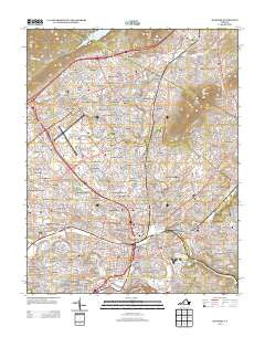
~ Roanoke VA topo map, 1:24000 scale, 7.5 X 7.5 Minute, Historical, 2013
Roanoke, Virginia, USGS topographic map dated 2013.
Includes geographic coordinates (latitude and longitude). This topographic map is suitable for hiking, camping, and exploring, or framing it as a wall map.
Printed on-demand using high resolution imagery, on heavy weight and acid free paper, or alternatively on a variety of synthetic materials.
Topos available on paper, Waterproof, Poly, or Tyvek. Usually shipping rolled, unless combined with other folded maps in one order.
- Product Number: USGS-5948970
- Free digital map download (high-resolution, GeoPDF): Roanoke, Virginia (file size: 34 MB)
- Map Size: please refer to the dimensions of the GeoPDF map above
- Weight (paper map): ca. 55 grams
- Map Type: POD USGS Topographic Map
- Map Series: US Topo
- Map Verison: Historical
- Cell ID: 38090
- Datum: North American Datum of 1983
- Map Projection: Transverse Mercator
- Map Cell Name: Roanoke
- Grid size: 7.5 X 7.5 Minute
- Date on map: 2013
- Map Scale: 1:24000
- Geographical region: Virginia, United States
Neighboring Maps:
All neighboring USGS topo maps are available for sale online at a variety of scales.
Spatial coverage:
Topo map Roanoke, Virginia, covers the geographical area associated the following places:
- Bellview Gardens - Rosalind Hills - Vista Heights - Fleming Court - Fairview - Summerdean Gardens - Fairmount - Fleming Oaks - Dwight Hills - Virginia Heights - Tinker Knoll - Brentwood - Preston Estates - Mapleton Heights - Oldfields - Bratton Lawn - Forest Park - Laurel Terrace - Gaymont - Brax-Han Court - Howell - Riverdale - Swarthmore Place - Janette Land - East Gate - Round Hill Terrace - Northview Mobile Home Park - Melrose - Alpine Hills - Airlee Court - Old Manor - Grove Park - Old Dominion Court - Colonial Heights - Lee Hy Court - Monterey Hills - Malvern Hills - Connistone - Lone Oak - Jackson Park - Vinton Heights - Brooklawn - Clifton Heights - Sunrise Heights - Meadowview - Otterview Gardens - Morningside - Franklin Court - Colonial Trail - Captains Grove - Herschberger Hills - Bluefield Heights - Northfield - Round Hill Park - Meadewood - Lincoln Court - Chatham Hill - Avendale - Blue Hills - Jamestown Place - Bowling Green - Summerdean - Sherry Court - Botetourt Springs (historical) - Burnette Heights - Lansdowne Park - Waterfall Lake - Dansbury Acres - Guilford - Thornecrest - Runaway Village - Arrow Wood - La Bellevue - Bowman Lawn - Plymouth Colony - British Woods - Brookside - Bluestone - Kenwood - Lilly View - Rosewood Park - Weaver Heights - Buckland Forest - Cloverdale - Bellview Terrace - Fairhope - Countryside Estates - Applewood - The Orchards - Bali Hai - Heritage Acres - Belle Haven - Westwood - Dillard Court - Rockydale - Shadeland - Southampton - Blue Ridge Heights - Cedar Bluff - Oak Hill
- Map Area ID: AREA37.37537.25-80-79.875
- Northwest corner Lat/Long code: USGSNW37.375-80
- Northeast corner Lat/Long code: USGSNE37.375-79.875
- Southwest corner Lat/Long code: USGSSW37.25-80
- Southeast corner Lat/Long code: USGSSE37.25-79.875
- Northern map edge Latitude: 37.375
- Southern map edge Latitude: 37.25
- Western map edge Longitude: -80
- Eastern map edge Longitude: -79.875


