
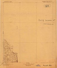
~ Purcell OK topo map, 1:125000 scale, 30 X 30 Minute, Historical, 1898
Purcell, Oklahoma, USGS topographic map dated 1898.
Includes geographic coordinates (latitude and longitude). This topographic map is suitable for hiking, camping, and exploring, or framing it as a wall map.
Printed on-demand using high resolution imagery, on heavy weight and acid free paper, or alternatively on a variety of synthetic materials.
Topos available on paper, Waterproof, Poly, or Tyvek. Usually shipping rolled, unless combined with other folded maps in one order.
- Product Number: USGS-5930903
- Free digital map download (high-resolution, GeoPDF): Purcell, Oklahoma (file size: 3 MB)
- Map Size: please refer to the dimensions of the GeoPDF map above
- Weight (paper map): ca. 55 grams
- Map Type: POD USGS Topographic Map
- Map Series: HTMC
- Map Verison: Historical
- Cell ID: 396094
- Scan ID: 802576
- Survey Year: 1898
- Datum: Unstated
- Map Projection: Unstated
- Map published by United States Geological Survey
- Keywords: Nonstandard Press Run
- Map Language: English
- Scanner Resolution: 508 dpi
- Map Cell Name: Purcell
- Grid size: 30 X 30 Minute
- Date on map: 1898
- Map Scale: 1:125000
- Geographical region: Oklahoma, United States
Neighboring Maps:
All neighboring USGS topo maps are available for sale online at a variety of scales.
Spatial coverage:
Topo map Purcell, Oklahoma, covers the geographical area associated the following places:
- McLoud - Gaddy - Maguire - Trousdale - Little Axe - Slaughterville - Willow View - Flynn - Harrah - Washington - Spring Hill - Morvin - Dale - Tribbey - Eason - Noble - Midwest City - Hall Park - Nicoma Park - Moore - Macomb - Burnett - Hazel Dell - Midway - Etowah - Norman - Clothier - Midway Village - Bethel Acres - Woods - Choctaw - Clarks Heights - Purcell - Smith Village - Needmore - Stella - Del City - Franklin - Goldsby - Lexington - Denver - Pink - Valley Brook - McKiddyville - Newalla
- Map Area ID: AREA35.535-97.5-97
- Northwest corner Lat/Long code: USGSNW35.5-97.5
- Northeast corner Lat/Long code: USGSNE35.5-97
- Southwest corner Lat/Long code: USGSSW35-97.5
- Southeast corner Lat/Long code: USGSSE35-97
- Northern map edge Latitude: 35.5
- Southern map edge Latitude: 35
- Western map edge Longitude: -97.5
- Eastern map edge Longitude: -97


