
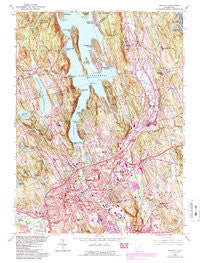
~ Danbury CT topo map, 1:24000 scale, 7.5 X 7.5 Minute, Historical, 1963, updated 1984
Danbury, Connecticut, USGS topographic map dated 1963.
Includes geographic coordinates (latitude and longitude). This topographic map is suitable for hiking, camping, and exploring, or framing it as a wall map.
Printed on-demand using high resolution imagery, on heavy weight and acid free paper, or alternatively on a variety of synthetic materials.
Topos available on paper, Waterproof, Poly, or Tyvek. Usually shipping rolled, unless combined with other folded maps in one order.
- Product Number: USGS-5688586
- Free digital map download (high-resolution, GeoPDF): Danbury, Connecticut (file size: 19 MB)
- Map Size: please refer to the dimensions of the GeoPDF map above
- Weight (paper map): ca. 55 grams
- Map Type: POD USGS Topographic Map
- Map Series: HTMC
- Map Verison: Historical
- Cell ID: 11292
- Scan ID: 461611
- Imprint Year: 1984
- Woodland Tint: Yes
- Visual Version Number: 2
- Photo Revision Year: 1984
- Aerial Photo Year: 1982
- Edit Year: 1984
- Field Check Year: 1963
- Datum: NAD27
- Map Projection: Polyconic
- Map published by United States Geological Survey
- Map Language: English
- Scanner Resolution: 600 dpi
- Map Cell Name: Danbury
- Grid size: 7.5 X 7.5 Minute
- Date on map: 1963
- Map Scale: 1:24000
- Geographical region: Connecticut, United States
Neighboring Maps:
All neighboring USGS topo maps are available for sale online at a variety of scales.
Spatial coverage:
Topo map Danbury, Connecticut, covers the geographical area associated the following places:
- Ta'agan Point - Wildmans Landing - Margerie Manor - Aqua Vista - Danbury - Cedar Heights - Candlewood Orchards - Beckettville - Candlewood Shores - Brookfield - Pleasant Acres - Hollywyle Park - Candlewood Pines - Hawthorne Terrace - Germantown - Candlewood Knolls - Candlewood Lake Club - Snug Harbor - Knollcrest - Brookfield Center - Hayestown - Lattins Landing - Beaverbrook - New Fairfield
- Map Area ID: AREA41.541.375-73.5-73.375
- Northwest corner Lat/Long code: USGSNW41.5-73.5
- Northeast corner Lat/Long code: USGSNE41.5-73.375
- Southwest corner Lat/Long code: USGSSW41.375-73.5
- Southeast corner Lat/Long code: USGSSE41.375-73.375
- Northern map edge Latitude: 41.5
- Southern map edge Latitude: 41.375
- Western map edge Longitude: -73.5
- Eastern map edge Longitude: -73.375


